Canyonlands and Dead Horses

One of the reasons why Canyonlands National Park is recollected with such fond memory is that the history here is real and apparent, exceptionally believable and imaginable, as if you can reach out and touch it and bring it back to life. History is something that intrigues me, especially history of the West, of the Cowboys out on the plains with chuckwagons and cattle, pushing themselves to extremes, kicking up dust, and taking with every quench of thirst a side of desert grit- also the natives connecting with the land, battling their rivals in bloody encounters, carving their tales into the rocks around them, forming, creating, and leaving mysteries of their existence. Just days prior to visiting Canyonlands, I began reading the book “The American West,” and here in Canyonlands everything was put in its place, in scene, in context. I was here in the midst of what I was reading. These lands held the routes of the early cowboys, the homes of the Utes and Navajos. They ventured through this rough terrain and endured the harshness of the desert. Still to this day, surrounding the park on many sides are pastures of cattle, modern day cowboys, and Native Americans blending tradition and culture.

When you’re traveling from point A to point B, outside of the park, and pass over many cattle gates and plains stretching with herds, the west of Cowboys and Indians, which has often been elevated to the point of near folklore, is true, embraceable, and able to be seen.

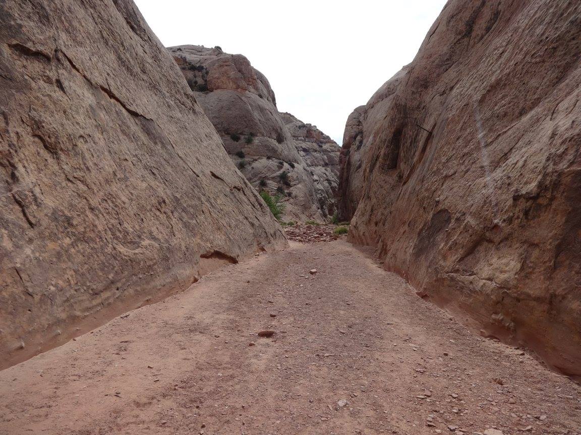
In my wanderings around Canyonlands, I took a short hike long a trail that passed by a rock overhang. In the shelter of the overhang was equipment and items left by cowboys of the past, including tables, trunks, saddles, cups and cans. I remember in that moment, I paused and I tried to imagine the transient life of the cowboy out in these harsh canyonlands of intense heat and dryness. The amount of bravery and perseverance of the cowboys is incredible. 

Just next to the boundary of Canyonlands National Park is Dead Horse Point State Park. Here I took a morning jog along the canyon rim, which ended right at the overlook of the Dead Horse Point itself. In front of me was a wild expanse of canyons and an elevated peninsula which the Green River dramatically curves around. The air was dry but the desert was not yet sweltering. Everything around me was painted in vibrant shades or orange, red, and pink. When I was done admiring the scene, I went into the visitor center. “So tell me, what’s with the name Dead Horse?” I asked.DSC04660

The park employee gladly explained, “cowboys traveled long distances out in the desert with little water. They were very thirsty and their horses even more so. They followed the sound of the river to the outcropping of land you see at the bend of the river. When they arrived There they stood right next to the river but far above it. They could see it and hear it,  but had no way to get down to it, and so their horses died, thirsty, looking at the unreachable river.”

In the gift shop I bought a book called “Down the Great Unknown: John Wesley Powell’s 1869 Journey of Discovery and Tragedy Through the Grand Canyon. The employee informed me that there was the John Wesley Powell River History Museum not far away, unfortunately I didn’t have the time to visit.

Although I had debated even stopping at Dead Horse Point State Park, I am glad I did. It compliments Canyonlands National Park and the views of the Canyonlands and Dead Horse Point were alluring and picturesque views. Something very unique about this region is you have Arches National Park, Canyonlands National Park, Dead Horse State Park, and numerous other parks and natural features all within close distance, with Moab, Utah being the central town, the hub, in the middle.

Back in the National Park I didn’t see much during the day. I was out on a small trail of barren rock faces taking photos over at the beautiful spiky rock formations in the Needles District when an angry looking storm came rolling it. I could see it moving, and see the sheets of rain it carried and the bolts of lightning it send snapping to the ground. In this moment the sky and scenery were perfect for photo taking, but some dust was stuck in my camera lens and I realized the approaching danger of the storm. I quickly satisfied my need to take photos with a few good shots and returned to my car just in time before the downpour. In the West storms are much more frightening, with the knowledge that water is not soaked into the land but rather travels across it, and also because in the desert there is rarely anything taller than your vehicle. So you and your car stand out, exposed, and are in plain site for the storms and all its bouts of lightning. With what I’m used to, a car provides adequate shelter from a storm, but not in these parts. I took more trustworthy shelter in the visitor center.DSC04533

When I was at Arches National Park, just days prior, I had heard about the Summer storms in the park film, which endangered some of the arches in the park, but I had no way to fully understand them. The land seemed so dry and the sky unyieling to any clouds. Trying to imagine a storm in these parts was difficult. Now, in the midst of one, It was completely understood. This storm just wasn’t any storm. It needed a modifier in front of it. This was a “Summer storm.” But like all Summer storms on these barren planes and canyonlands, it didn’t last long. It came and went, in a quick heated tantrum.

Canyonlands National Park is composed of three districts, each with unique lands features. There is Island in the Sky District, the Needles District, and the Maze District. In the visitor center in the Island in the Sky District  I inquired about hiking down into the Needles District I had seen from my hike. The park ranger took out a white binder with photos slid into plastic sleeves. He turned to a specific page and pointed to it. “Well this is the Needles District.” He paused for a moment, as if the photo itself would be a deterrent. It wasn’t. It looked amazing. “There is no cell phone service out there…” Fine with me. He proceeded, “…and GPS devices won’t work in that area from the rocks blocking the signals.” His last piece of information successfully deterred me from exploring the area. I had read online that it was ill-advised to go alone, as all the rock formations which stick up like needles create a maze-like environment, and it’s very easy to get lost. It was advised that you take pictures at turning points in your trail to be able to navigate backs to your starting point. That knowledge paired with the fact that my GPS would not work, resulted in the decisions to not explore the Needles District. I had already been hiking in the area enough to know the heat and dryness was a serious thing. Being lost here could be deadly, and I didn’t want to end up like the horses of Dead Horse Point.

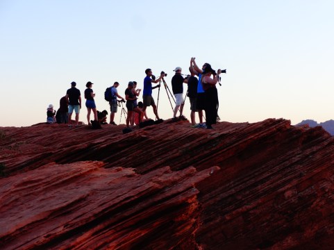
When the rain had resided I made it to Mesa Arch- the most iconic feature in the park. It’s a small rock arch right on the edge of a canyon cliff. It’s not much taller than myself but what makes it so appealing is that it frames the canyonlands behind it perfectly and is positioned at just the right angle that sunlight always brings out color in the landscape, making this location an exceptionally good photo spot at sunrise and sunset. Now, after having visited Mesa Arch, I notice it frequently in screensavers, calendars, and different pieces of publicity.  While I was there, a group of young adults from France asked me to take their picture. I had seen them the day before in Arches National Park. There was a small crowd of people gathering, but everyone was very respectful, stepping aside for each other to take their pictures of the arch.DSC04581

At one point in my day I took a break and went into Moab for lunch. I ate at the Moab Diner, which was a very pleasant experience. I would recommend it to anyone in the area. Not only was the food delicious but the service was unparalleled to anything else. The waiters were extremely attentive, and I must have had my glass of water refilled at least five times without any wait. I had gotten the Kokopelli Chicken Sandwich. It was here I was also able to make the association that Kokopelli is the flute player in the petroglyphs. His image is reproduced all over merchandise and signage in the area. He is a fertility deity and represents the spirit of music. I don’t know much else about Kokopelli, except his chicken sandwich was delectable.

Nearing the end of the day, I returned to Canyonlands to walk to Grand View Point at sunset. This walk would prove to be a pinnacle of self-actualization and discovery on this trip, and will be outlined in my next chapter, but after my hike along the rim, I began driving back to my hideout in the mountains of Manti Lasal. Shortly outside the park I drove by a Bureau of Land Management sign for Horse Thief Campground. Weary from a full days adventure I thought I would check it out and entertain the idea of camping here instead. Sure enough there were campsites available. I decided I’d rather dish out fifteen dollars then drive 60 more miles in the dark back to Manti Lasal. Although my tent was all set up in Manti Lasal, I had my spar tent, Kelty, and an extra sleeping bag in my car. I also had one of my compact camping pillows. I would be alright. I sent up camp there in the flat exposed plain. The sky above me was extremely huge. Clouds were long gone now, and stars filled the sky. I was able to purchase some firewood on the grounds and quickly had a small fire blazing. I was camping, like the cowboys I read about, out on the expansive plains, with the whole sky above me.

I realized here that I could position a flashlight underneed my glow-in-the-dark Nalgeen bottle, and the bottle would disperse the light, creating a calm but sufficient glow by which I could eat a snack and write a few postcards. When my writing was complete, and the air grew cool and hollow, I crawled into my airy tent, pulled out my book on the West, and read to the sound and glow of the fire next to me and the brightness of the unhindered moon and stars above me. I was at peace.

Read the next entry “The Canyons in My Life,” here: https://joshthehodge.wordpress.com/2017/12/27/the-canyons-in-my-life/

Read the previous entry “Camping in Strange Woods,” here: https://joshthehodge.wordpress.com/2017/11/12/camping-in-strange-woods/

Facebook: http://facebook.com/joshua.hodge

Instagram: http://www.instagram.com/joshthehodge/

Camping in Strange Woods

The sun had set, but there was still enough light  for me to barely see some of the wildlife around me. I passed nearly a dozen deer alongside the road. I was driving slowly, ascending an unknown mountain. An eerie unsettling sense of skepticism crept in. I was 60 miles removed from the bustle of Moab and just south of Canyonlands National Park. I had no framework to understand exactly where I was heading. I had a campsite reserved somewhere out here and had the coordinates entered in my GPS.

“You have reached your destination,” my GPS cordially sounded. There was nothing there, so I continued on. After a few miles later up the mountain, I decided I better head back down and have another look.  Sure enough, the second time I noticed my destination. There was a road. It was hard to see, and the entry onto it was through a cattle guard that had been nearly hidden with vegetation. Grass was growing up in the middle of it, and vines were wrapping around it. Furthermore, the branches of the trees hung low, and my vehicle would likely brush up against them. I eyed the thing for a moment. There was a sign “Buckboard Campground.” This was it. The grate of the cattle guard was very wide. Will my wheels get stuck on that, I thought. There’s only one way to find out. My car shook violently as it crossed the guard and shimmied through the tunnel of overgrowth. Then I was in.

There is no point in trying to recollect and recount my camping experience that night in the mountain, because in the intensity of the moment, I documented just what was going on:

Let it be documented that if there is ever a night I go strangely missing, it is tonight.

I am at Buckboard Campground in Utah. I found it impossible to find a campsite in Moab, so I’m sixty miles south in Manti Lasal National Forest.

To arrive, I entered into the middle of nowhere and ascended thousands of feet into a thickly wooded forest of some sort of non-pine tree with a white trunk. I think they are aspen. I have never been in a white forest before. I’m sure in the morning light it is beautiful, but at night the unfamiliarity is eerie. The moon is super bright and it makes the trees look as if they are glowing.

Because this type of forest is new to me, I don’t know what dwells in these woods. Are there bears? I just bought a ton of produce, being sick of granola bars, dried nuts and berries, and jerky, and my sleeping bag smells like Subway. I bet my feet smell delicious too.

And I’m all alone. No one else is up here at this campground. So it is the perfect place to be kidnapped or snatched by Sasquatch, or Scarfinger, or the aliens in the petroglyphs I’ve seen today and yesterday. They may come to abduct me.

There are so many possibilities for my demise and disappearance. I’m trying to make light of the situation, but in all sincerity there is uneasiness and concern. I am completely isolated and alone in a strange place.

I quickly built a fire and turned on five flashlights, establishing my neck of the woods. And I tried to bear proof my car, but I’m simply carrying too much food. I am looking forward to sunrise. Please come soon.

Despite my trivial panic, I survived. To calm myself and make myself feel more at home, I broke open my new book about the West and I became intrigued and lost in it’s great story. I occasionally kicked the sides of my tent to create noise and scare off intruders, whenever I heard leaves ruffling. Despite my initial fear,  I slept very well.

I awoke the next morning in an absolutely beautiful aspen forest, and two deer nonchalantly walked right in front of my tent. I opened my tent window and talked to the deers for a moment. Tree trunks were vibrantly white and the leaves of the aspen created a glowing green canopy just above me. I fell in love with the aspen forest. I’ve been a huge fan of the aspen ever since.

DSC04476

Read the next entry, “Canyonlands and Dead Horses,” here: https://joshthehodge.wordpress.com/2017/12/27/canyonlands-and-dead-horses/

Read the previous entry “Seizing the Moment,” here: https://joshthehodge.wordpress.com/2017/11/12/seizing-the-moment/

Facebook: http://facebook.com/joshua.hodge

Instagram: http://www.instagram.com/joshthehodge/

Seizing the Moment

“A whole month of camping! How do you stay clean?” This is a question I often get asked. There are a couple of answers I could give: “I don’t” or “let me tell you…” I have gone for a week without a shower, but that is pretty much my max. I find ways, maybe not to stay clean, but to get clean from time to time, when opportunity affords it.  Most National Parks in the West do not have shower facilities, unless it’s a largely popular National Park, then you might find a coin shower, like in Bryce Canyon or Yellowstone. There’s a zero chance of finding a shower in a National Forest facility, as their standard is just a vault toilet and maybe, if you are lucky, a sink. Last year, when I was camping in Sequoia National Park, I counted a swim in a river enough of a bathe for me, but you should never bring soap or shampoo into a river. It can be harmful to creatures who inhabit the waters.

When no park shower facility is available I get creative. Often times I resort to getting a day pass to a gym and taking full advantage of the shower in the locker room. Gold’s Gym’s are popular throughout the West, and a day pass is well worth it. For Moab, I had to do a bit of prior investigation, but I did had a shower planned in my itinerary. Online I had found Moab’s Recreation and Fitness Center. They expect visitors and charge solely for shower use, but they also offer a day pass to the gym. It has become my practice that If I’m going to shower at a gym, I’m going to get a good workout in too. As someone who is tall and lanky, with a fast metabolism, days on end of hiking, causes me to lose muscle weight. I try to salvage some muscle by tearing it up in the gym and making sure I follow up with enough protein and nutrients to repair.

Moab’s Recreation and Fitness facility  was tucked away in the neighborhood in a very residential part of town. It was insightful to gain another perspective of Moab, apart from the Main Street of tourist shops and restaurants. The neighborhood was clean, quiet, and simple. I parked alongside the road and went in to workout and get cleaned up. The facility was sleek and looked very new. The receptionist was very friendly.

When I workout in the gym, typically I target one or two specific muscle groups. Since this was my first gym workout in a while, and would be the only one for days to come, I decided to work a little bit of everything.

When I’m back in Kentucky on normal time, I value lifting and working out in the gym for a multitude of reasons. One of them is that it keeps me physically fit to have these adventures. Pulling myself up and over rocks, climbing up steep slopes, hauling around large and heavy backpacks for miles, and the rare occurrence of holding onto a cliff edge for my life, requires that I have exceptional upper body strength. Also the self discipline developed in the gym, allows me to keep pressing forward when things get difficult.

After my workout, I was off to the shower. It felt absolutely amazing, as the salty sweat, layers of sunscreen, and desert dust was washed away from my face. I took in the comforting sensation of  warm water relaxing my back, which had become so accustomed to carrying a backpack.

Coming out of the shower, there were others moving in and out of the locker room, having just finished their own workouts. There were also kids having just finished swimming lessons going about in all directions. Wrapped in a towel, I laid my sitch bag on the counter next to the faucet and pulled out my shaving cream, razors, toothbrush, dental floss, and mouthwash. I had lots of personal maintenance work to be done. I felt rather awkward shaving in the midst of a bustling locker room. I remember when I lived in Houston, Texas, people would shave in the locker rooms, but that was in a major city. Much more is acceptable in big cities than in small towns. I didn’t know if this was socially acceptable here, but I went with it anyway. Even if people were to have passed silent judgement on me, it didn’t matter. They didn’t understand how valuable this opportunity was for me, and, plus, I was truly a stranger. I was here one day, but would be gone the next. I would make sure I cleaned up after myself, so what difference did it make?

When I left the recreation center, I felt clean and refreshed. Evening was approaching. The sky was clear and the air was hot but dry. The harshness of the sun had resided. An overwhelming sense of peace met me in this moment. There is a certain sense of accomplishment obtained from being able to live out of a car and travel wherever you want and still keep healthy and get clean. I remember returning to my car parked alongside the road and just feeling very pleased with life and myself. I felt good about my body having just cleaned, worked out, and shaved. I felt healthy and ready. I had some amazing things planned and adventures to be had. I pulled from my food supply a Muscle Milk and a protein packed crispy rice bar. I was relaxed yet ready for the evening ahead of me.

Before heading to my campground, I needed to run a few errands. I stopped by Walker Drug Company, which was a very impressive general store. It had a little bit of everything carefully and purposefully stocked- food, clothes, camping gear, souvenirs. In the East, the general store is pretty much nonexistent, except for the chain, Dollar General. In the West, the general store is still alive. I bought one of my dietary staples, Greek yogurt, to get some additional protein after working out, and I purchased a dual prong USB charger for the car. I was impressed because I had never seen a dual prong USB charger. Later this would prove to be a nemesis, blowing a fuse in my car.

From the general store, I went to City Market, Kroger rebranded for Utah. I was feeling sick of eating Clif Bars, jerky, and dried berries. I wanted some fresh food, So I bought some apples, oranges, bananas, and peppers, as well as stocked up on the usual. After loading the groceries in my car, I was feeling hungry and also wanted to find some Wifi to share the photo of myself by Delicate Arch. I stopped by a McDonalds. I got an Egg McMuffin (taking advantage of McDonald’s new all day breakfast menu) and an iced coffee. I pulled out my Chromebook, inserted my SD card, and began searching for the photo of me next to the arch. This was a tedious task, as the machine was very slow, with it’s memory at near full capacity, housing all my photos from last summer’s adventure.  While I was fumbling through the machine in search of the photo, a young man with hiking boots that were plastered with dusty Utah soil, and a McDonalds tray in hand, took a seat right next to me. I looked over to see if he was going to say anything, but he said nothing. I found this very peculiar, because the McDonald’s was very spacious, and numerous tables were open all over the place, but he chose to sit right next to me, our shoulders nearly touching. I could tell by his attire of cargo shorts, nylon t-shirt, and dusty boots that he had been out hiking. For a moment, I thought about striking up conversation, but I was waiting for him to do so. After all, he is the one who rather awkwardly sat next to me, right inside my personal bubble.

My great fault of not taking initiative in meeting new people was on prime display here. I wanted to strike up conversation and hear his story. Was he another solo hiker by himself? What did we share in common? He didn’t seem like he intentionally wanted to make me feel uncomfortable. He didn’t seem very confident himself. It was as if he and I shared a lot in common. I imagine he had mustered up enough confidence to sit down next to a stranger, but not enough to engage in step two: initiating a conversation. The social complex between us was very complicated. I felt that he innocently and sincerely saw himself in me and wanted to start a connection, but both of our social insecurities got the best of us. I just tucked my face away in my Chromebook and neither of us said anything.

Whenever I recall my experiences in Utah, this comes to mind. If I had struck up conversation with him, I wonder what would have become of the conversation. Would I have made a new friend. How much did we truly share in common? As someone who lives a rather solitary life, the prospect of finding a new friend is exciting to me, and forming a connection with anyone is very valuable and a rare occurrence to me. People sometimes misunderstand me and my solo adventures, thinking that I just want to be alone. Although I do enjoy some moments by myself, the reason why I adventure so often by myself is because there is no one else to share adventure with.  Coming across another person who shares the same adventurous spirit, no matter who they are, is exciting to me. This young man in McDonald’s could have been a valuable connection to share adventures stories with.

I can only conclude that this was a missed opportunity, and although I do believe everything happens for a reason, I think the takeaway from this is a lesson learned. From here on out I promised that If such an opportune situation for a social interaction comes my way I seize the moment, and not let the opportunity pass.

Read the next entry “Camping in Strange Woods,” here: https://joshthehodge.wordpress.com/2017/11/12/camping-in-strange-woods/

Read the previous entry “Trouble at Arches National Park,” here: https://joshthehodge.wordpress.com/2017/11/10/trouble-at-arches-national-park/

Facebook: http://facebook.com/joshua.hodge

Instagram: http://www.instagram.com/joshthehodge/

Trouble at Arches National Park

My heart was racing, What do I do now?  I looked down. This was the third time on my adventure I found myself in the dilemma of being in a high-up location, looking below me uneasily, wondering how to get back down. The big difference was this time there was an audience of spectators watching me. I had to make a decision quick. I did not want anyone coming to my rescue. This was embarrassing. I found myself crouched down low, legs extending, and finger-tips trying to clench the rough steep sand paper terrain.

I was at the base of Delicate Arch- the most iconic geological feature of Utah. It wasn’t enough for me to see it and get my picture taken by it. I wanted to explore around it. As I went to hug the arch legs and shimmy my way around its base, I lost footing, gravity cleverly pulled me. I couldn’t stay standing any longer, and as my body and limbs were spread out across the terrain like a spider, I was afraid that any slight movement might send me tumbling into the desert bowl below me. The bowl just below the arch appeared as if years of weather and wind carved it out. Sandstone swirled around to form the bowl and reached up to connect to the towering Delicate Arch, where I was pulling my Spiderman moves, trying to hang on, hoping friction would be on my side.

I realized there was no going back up, because I would have to turn my body around, and there was no place to do so. I would plummet. So I had to proceed forward. I had to descend into the bowl. The only problem was that it was a long and steep way down, and it looked near impossible to descent without fall. If there were to be a fall it would be detrimental, for all of the ground was rock, and there was absolutely nothing to grab onto to break the fall. I would be sent rolling uncontrollably on the sandstone.

With wobbly legs and a queasy fear of the heights, I brought myself back onto two feet and immediately began my descent. I was running, trying to pair myself with gravity and avail a complete fall. My feet stopped forcefully on the sandstone, as I speedily propelled down into the bowl. My focus was staying on my feet and not falling out of control. With each passing second, as my feet stomped their way down into the bowl, I wasn’t sure if I would remain standing.To quote famous cowboy, Woody, you might say I was “falling with style.”  Despite my clumsiness, I made it! I was in the rock bowl looking up at Delicate Arch, relieved, thankful to be unharmed, and gaining a view probably not too many people get to see of Delicate Arch.

When I first set out to explore around Delicate Arch, I thought it was normal, but now judging the terrain, I knew this was not something people do. Furthermore, it was probably off limits. The last thing I needed was to get in trouble by the National Park Service, an organization I volunteer with and so admire. I needed to get back on trail and blend in. I felt like an offender of the landscape. I was thoroughly embarrassed, knowing that my whole shenanigan was witnessed by dozens of tourists. Finding the trail involved hiking down into another bowl and climbing a much shorter distance up and out onto the trail. Once back on the trail, I felt like I needed to hike back to Delicate Arch and bid it farewell.

Thus was the extend of my main adventure in Arches National Park. The trail to Delicate Arch was one and a half miles and decently strenuous, working the calves and thighs as it is mostly an ascend on bare rock face. Near the trailhead, there is a little off shoot trail that leads by some petroglyphs. I took it in on the way back, and met a couple from Cincinnati, Ohio. I overheard them talking about the horned looking monster in the petroglyph and how they noticed the same creature in the petroglyphs in Capitol Reef. “Aliens. They have to be aliens,” the wife informed. Since I had just been to Capitol Reef, I found it would be interesting to engage them in conversation. We talked petroglyphs and the nature of our trips, and they said they applauded me for venturing out on such a trip alone. In addition to this main hike, I also pulled over and took the very quick hikes to Double Arch and Balanced Rock. At Double Arch I was recruited by a small group of Chinese tourist to take their picture. I was asked through a series of gestures, since we couldn’t verbally communicate. Pointing at my camera and then myself, I was able to get them to return the favor. This park was very busy and full of people from all over. I had noticed many tourists from China and Germany. Parking was very tricky, but I was lucky.

Prior to arriving at the park, as I was approaching, I had tuned into an AM radio station designated for the park, which was warning tourists that the park was expecting a large number of visitors and not to stop on the highway if the entrance to the park was backed up. I did not have this problem, as I had arrived fairly early in the morning. Once in the park boundary, I ascended a large switchback road to higher ground where I stopped at the visitor center. I watched the park film and bought my customary souvenirs. It was a very nice and modern visitor center, and the park film spoke a lot about the summer storms and how Delicate Arch was just one summer storm away from being broken and knocked down. It made me speculate that perhaps in my lifetime Delicate Arch would be no more, just like the fate of the Old Man on the Mountain in New Hampshire, whom I visited as a child but who no longer exists.

Also in the visitor center, I decided to take care of my bookless dilemma. I bought a 448 page book called The American West, a general history of the region, and a book about coyotes, geared towards kids, but it had a lot of great coyote picture and facts that informed my purchase. Throughout my travels, coyotes have come to be my favorite animal, and I wanted to learn more about them. Not being a bearer of a smartphone, I relied on old-fashion methods to gain my knowledge while traveling.

Just outside the visitor center there were two water fill stations- spickets attached to pillars. Hikers gathered around and lined up to fill up their water bottles and hydration packs. There was definitely a spirit of adventure in the air, being surrounded by people with hydration packs and bottles of all shapes and sizes, all gearing up for their own explorations, I figured I should fill up on water as well, so I brought over my nalgene bottles and hydration packs and became fully stocked up on water.

After Arches, I headed into Moab, the nearest town, and epicenter for outdoor adventure in Utah. This town is a major hub for the outdoor enthusiast. Everything is geared toward, and accommodating for, the adventurer. The town itself is very small. According to a 2016 census the population was 5,242,  but the number of outdoor adventurers visiting is great and probably outnumbers the people living there. Although tourists were coming from all over the world to experience the wonders of Utah, bringing their own culture and customs, adventure and discovery bound us together, and because of that it was as if we all spoke a common language.

DSC04411 (1) copy

Read the previous entry “Coming Back to Life,” here: https://joshthehodge.wordpress.com/2017/11/06/coming-back-to-life/

Read the next entry “Seizing the Moment,” here: https://joshthehodge.wordpress.com/2017/11/12/seizing-the-moment/

Facebook: http://facebook.com/joshua.hodge

Instagram: http://www.instagram.com/joshthehodge/

Coming Back to Life

It was only supposed to be a two mile hike, but it felt like twelve. It was day two in Capitol Reef National Park, and I had set foot in the morning on the Rim Overlook Trail to catch a view of Fruita from above. Never before had I been on a trail that was so short yet seemed so long. I believe this perception was gained in part from the tedious task of maneuvering my feet around rocks, watching out for rattlesnakes, and searching for cairns to keep me en route. On top of that, add extreme heat and sun exposure. There was also the repeatedly false perception that the trail was coming to an end. I would see an outcropping of land along the rim, and assume it was the end, only to find out the trail wound around and kept going. This happened maybe a half dozen times.


The trail eventually ended at Fruita Point, and I looked down into the canyon. It wasn’t the viewpoint that was the highlight of the trek, as it was forgettable, but what stays with me most vividly in my memory is the hike there, through shambles of broken rocks, across expansive sun baked rock faces, and through indentations and coves of sand. At one point I rested, stretching myself out in some soft sand, as if reclining at beach, but I was really in a sunken cove, hidden by desert brush. At another point I sat in a smooth rock cavity, just my size, to find shelter from the sun.  Although seemingly long, the trail was fun, interesting, and throughout the whole trek I was accompanied by small lizards who would blend in so fine with the landscape but suddenly scurry upon the approach, causing me to flinch at their surprise.


When I was back down in Fruita, after my hike, I was very hungry and felt I had burned enough calories to earn a fruit pie sold at the little gift shop in Fruita. The town has a history of fruit harvesting and pie and jam making. I figured that in order to have the full Fruita experience, I needed to have some pie. I bought an individual blackberry pie and a small cup of ice cream (the kind with a wooden stick), and I enjoyed it on a picnic table out front. This area of Fruita was quite busy now, meaning there were a few families on the premise, but it was obvious, from overhearing their talking, that they were just day visitors. I was able to tune out all the noise around me and write in my notebook about my experiences in the Petrified Forest.


After eating my pie, I went for a walk around Fruia, I walked past the old school house, down by the river, and to a large section made into what sort of looked like a city park, with a mowed lawn and picnic tables. There I observed some very old girthy cottonwood trees. There was a placard explaining their significance, showing photos from back in the pioneer days of the same trees. Leaving this lawn area I walked by the orchard. I had read online and heard on the Rock the Park show that you could pick fruit from the orchard, but it didn’t look like they were allowing it at this time.


As I was walking by the orchard, some mule deer walked right up to me. I was not used to deer approaching me. Deer to me have been some of the most easily frightened animals, but these deers were approaching me, I had to curve my direction so they wouldn’t walk into me. I am used to deer in the Midwest and South, where they are so frequently hunted. Perhaps, because of this, they have developed knowledge and instinct to avoid humans. But here, tucked away in a desert oasis, protected by the National Park Service, humans are not feared.  Wherever humans go, they usually bring food, and in this area food was not in plenty, so perhaps the deers welcomed humans in hopes that humans would provide for them. I’ve observed in my travels that desert environments bring out boldness and aggressiveness in all creatures.


I myself was ready to aggressively search out food and water. I was craving with great intensity cold water. I was prepared with water, but my water was hot. I wanted cold water,  and I craved food other than nuts, berries, and jerky that I had packed away in my car. I searched in my GPS for restaurants. The nearest was a Subway, thirty miles away. Typically, by no means, would I drive 30 miles just to go to a Subway, and furthermore it had been my tradition that once in a National Park for a stay, not to leave it. However, the thirst and hunger was so present and nagging, that I decided that even for just a sip of cold water, 30 miles there and back would be worth it.


The miles went by quickly, and I found the Subway located inside a gas station. That Subway sandwich and water mixed with artificial lemonade syrup made me the most appreciative of beings. In the gas station I also bought a bag of Muddy Buddy Chex Mix. The sweet powdery crunch was so satisfying and so memorable, that it created a powerful association in my mind, so much so, that from that point on Muddy Buddy Chex Mix has become my preferred snack on summer camping road trips.


On my way back into Fruita, I stopped at the entrance sign to Capitol Reef National Park to take a picture and then I pulled over at Sunset Point. I thought the sun was soon setting, and here I could take it in. I came to discover that the sun had already set behind the reef. Nevertheless Sunset Point proved to be a beautiful viewpoint. From here I looked down into deeper canyons and up at mountains in the far distance with the giant walls of Capitol Reef to my left. I thought that this place was beautiful, and it was one of those moments in which I really became aware of not only my existence but my own presence in this place. I closed my eyes for a moment to attune my ears to the quietness around me. I opened them to rediscover myself in this amazing and strikingly different landscape from what I was used to. I recollected where I came from, all the hardships of life I have endured, and here and now I was with the will and aptitude to have brought myself to remote Utah and immerse myself in natural beauty. With all the peace surrounding me, and the spark of adventure now ablaze, I realized I was still on the front end of a large summer adventure.  But already I was feeling restored, alive and free. Nature always has a way of bringing me back to life. (The Subway sandwich also helped.

Read the previous entry “The Way of the Pioneer,” here: https://joshthehodge.wordpress.com/2017/10/29/the-way-of-the-pioneer

Read the next entry “Trouble at Arches National Park” here: https://joshthehodge.wordpress.com/2017/11/10/trouble-at-arches-national-park/

Facebook: http://facebook.com/joshua.hodge

Instagram: http://www.instagram.com/joshthehodge/

The Way of the Pioneer

“Oh you’re from Kentucky? That’s different,” the hiker responded. I wasn’t sure how to interpret this at first, but really I understood exactly what he meant. It happens to me all the time when I travel. “I’ve never met any visitors from Kentucky” a few rangers have told me before. Having lived many places, I don’t always claim I am from Kentucky, but when I do, it always summons an interesting response. Among the responses is often, “You don’t sound like you are from Kentucky.” This is true, because I am not, nor ever will be,  a true Kentuckian. I was born in Chicago and raised primarily in Massachusetts. However, my family roots run deep in the fertile soil of Illinois.

Despite not originating in Kentucky, I am quick to defend Kentucky within reason on many accounts, but I cannot deny that on large, many Kentuckians are not known for venturing out, and if they do it’s usually to the same few places. On top of that, Capitol Reef is really venturing out- the most remote National Park I had been to thus far.

I came upon this hiker and his wife who inquired where I was from, coming out of the Pioneer Register. The Pioneer Register is a slot canyon graffitied by carvings of pioneers and their dates of passage, dating back to the  early 1800s. The Pioneer Register is an incredible place because of hundreds of names of people who passed through the narrow canyon. It’s also fascinating to consider how they were traveling on stage coach, over rough rocky terrain in the desert heat, squeezing their way through rock walls. I’d want to reach out to them and say, don’t lose heart, you are almost to Fruita.

Walking through the canyon, I imagined the fear of flash floods must have been very real for the pioneers. There would have been no escape from flood waters down here, and flash floods truly do come unexpectedly. In Utah, where much of the ground is hard rock, water is not absorbed into the ground, instead it moves and can travel from a stormy location to a place where the weather is blissfully fair. These pioneer would have had no warning of flash floods.

Looking up and marveling at the extensive register of names I noticed how some people chose to carve their names in beautiful cursive. Others had left their names carved into the wall by series of bullet holes. It would be painful to imagine how loud it must  have been, with the sound of the gun echoing off the canyon walls. An aspect that makes this location all the more interesting is that it is unmarked. It’s not behind a fence or protected in glass. It’s just there, exposed on the canyon walls, and you can walk right up to, and walk through the canyon, seeing the same views and experiencing the same journey as these brave pioneers.

This was around mid day of my first day in Capitol Reef. I had just previously hiked up to Cassidy Arch, but now was down on the low lands. This couple I came upon asked me to take their picture inside a hollowed out hole in the canyon wall. I too asked for them to take my picture, but it didn’t come out well. I am particular about my photos and my artistic eye is not always pleased when another attempts to capture my vision. We got to talking and these people told me they were from California. They had been to Death Valley, and the wife was wearing a Death Valley shirt. I took notice because that is my favorite National Park. Inquiring about what I do for work, we eventually got on the topic of Mexico City. “What’s that neighborhood in the city, that’s very beautiful with the home of Frida Kahlo?” The man asked. “Coyoacan!” I exclaimed. Of course! The topic of Mexico City is also one of my favorites. I’ve spent a lot a time there as a student and also on various vacations. The husband advised that if I loved Mexico City  I would love visiting Buenos Aires, Argentina. It just so happened to be one place I was already interested in visiting.

Upon bidding farewell to the couple, I returned to my car and the adventurous dirt road back to Fruita.  I had completed my hiking agenda for the day, was tired and just wanted to rest in my little desert oasis. I had new appreciation for Fruita, having been to the Pioneer Register and trying to put myself in the perspective of the pioneers. Fruita would have been, in some ways, a paradise, with  trees providing shade, the Fremont River flowing nearby, orchards of fruit, and villagers to accommodate. Despite the excitement Fruita may have been to pioneers, at my campsite, I found myself bored, which is a very rare occurrence for myself. It was too late and I was to tired to begin another hike. I had studied the park map, read the newsletter, and didn’t know what else to do. I recollected my experience in Saguaro and wrote a brief poem. After lying restless in my tent, craving some relief from the valley heat, not knowing what to do with myself, I realized what was missing in my life- a book. I needed a book. I wanted to read. Reading in relaxing, distracts from the discomforts, in this case heat around me, and put me in a place of peace. But I had nothing left to read, except I recalled I had my novel in the works saved on my Chromebook. I fired up the machine and started reading my own work. At this point I had twenty five pages written of the novel.

Despite its comfort, reading didn’t last long, as hunger was nudging me to start the fire and eat some food. I got out of my tent, started a fire and heated a can of chicken noodle soup. In the heat of the valley, soup was not the most enjoyable of meals, and all my water supply had turned hot, from the day’s sun. Also, during my meal, flies started to pester me to the point of irritability- the annoying buzz and humming around my ears, the occasional attempts to dart at my eyes. These little flies were not my friends. I didn’t want to spend all evening in my tent, so I figured if I climbed up to a higher elevation, I might escape them. They seemed to thrive among the greenery and water of the Fruita valley. So, I filled up a  hydration pack, threw on a long sleeve shirt- anticipating the weather to cool down soon, walked across the road to a trailhead, and took a very short hike halfway up a trail leading to the plateau above. I was very tired, my legs feeling weighted. I sat down, rested, and looked down into Fruita at the campground and an old barn next to a small field for horses. It was scenic and picturesque but despite my attempt to escape, the flies followed me. Heat, wasn’t so much the problem, but the dryness, thirst for cold water,  mixed with the pestering  flies, made me into a highly irritable creature. I realized the remedy I really needed was a good night’s sleep. I had not caught up on any of the time lost after skipping over two time zones. I hiked down to my tent, brushed and flossed my teeth in the campground bathroom (because dental hygiene is never compromised when I camp) and checked into my tent for the night. I read over the poem I wrote about Saguaro as well as a few from previous summers, and I fell asleep.

13738071_10210469450032929_2811238607855046720_o

Read the previous entry “Utah, My Love,” here: https://joshthehodge.wordpress.com/2017/10/17/utah-my-love

Read the next entry “Coming Back to Life,” here: https://joshthehodge.wordpress.com/2017/11/06/coming-back-to-life

Facebook: http://facebook.com/joshua.hodge

Instagram: http://www.instagram.com/joshthehodge/


Utah, My Love

Utah is an incredible place. Although it’s a popular place for hikers, in my travels it has often seemed like I’ve had the whole place to myself. On my way to Capitol Reef National Park I hadn’t passed another car in a long time. Civilization was becoming sparse. I was filled with excitement to go to this lesser known National Park.

I first learned about Capitol Reef from the Rock the Park show in which Jack Steward described it as a “gem.” It was an intriguing episode, because the park was portrayed with such a unique balance of history and nature. Jack also described it as “The real wild West.” Growing up in, and always being confined to, the Northeast and Midwest, the wild West always seemed so unreachable and too legendary to bother with making my acquaintance, but here we were, about to meet!

Prior to my arrival, I knew some basics about Capitol Reef. It was a supposed hideout for outlaws, including the infamous Butch Cassidy. It also included a commonly traveled pioneer wagon route and the restored Mormon ghost town of Fruita, situated in an oasis tucked down between the giant rock walls. It was named Capitol Reef after a giant rock feature on top of the Reef, which pioneers thought resembled the U.S. capitol building. I wanted to see it all for myself and was very curious what the “Reef” itself would look like- a 100 mile outcropping of earth pointing to the sky.

The two hour drive from Bryce Canyon to Capitol Reef was very peaceful and marked by tranquility, yet unbridled anticipation. I was driving down the long wavy landscape, swooping down and rolling up to see new marvels at each crest. I had gotten another early start as to be able to secure a campsite in Fruita. As I was traveling down the open roads, the morning sun was still waking up, slowly peering over mountainous deserts and lush fields of the remote Utah farmland. The temperature was brisk and in the lower fifties. The sun didn’t seem to be in a hurry but stretched casually, illuminating the beauty around it, turning dark grey areas to vibrant oranges and greens. As I approached the park, red giants stood up all around me. They announced their existence boldly and reached dramatically into the sky- some layered with colors, others monotone. Between the road and these giants were just fields of sand and rocks mixed with typical desert shrubs. It very much reminded me of the landscape in Disney Pixar’s original Cars movie. It felt like in any minute I’d be pulling up to Radiator Springs.

The Reef itself jutted diagonally up into the skype, as an immense rock ledge. In the park film, I learned that it is believe it was formed by plates of land colliding, pushing one plate up into the air, creating this massive wrinkle in the earth’s crust.

I was traveling alone. Dom had taken off in a different direction. He had forgotten to pack his camera battery and had found a place online in Moab, Utah that sold it. He was going to seek that out. When I rolled into the park, I passed the small visitor center and headed straight to Fruita. I didn’t have much pick of a site, because the campground was small and many sites were taken.

The whole campground was flat and had a mix of green grass and desert dust. It was all fenced in, so it did not have much of a wild feel. Roads were paved, sites plainly arranged. It was a very civilized campground, yet very scenic, because it was tucked away between giant red walls situated in small and picturesque Fruita. I chose a site in the front left corner of the campground. I quickly set up camp. Knowing I would stay a few days, I decided I would rest spaciously in True Blue. I then purchased some firewood from the campground host and headed back to the visitor center, as always to watch the park film, purchase a pin and sticker, and ask a ranger for hiking recommendations, despite already having an agenda. I then hit the park road.

The first hike on the agenda was to Cassidy Arch. It was a 6.6 mile round-trip hike. The trail arrived at a place believed to be a hideout spot for the infamous criminal it’s named after. To get there I drove on a extremely scenic dusty dirt road in an expansive area between enormous rock walls where my little rental car kicked up a large trail of dusty clouds. I stopped at numerous spots to take pictures. The giants walls, and bold rock formations around me, made me feel so small and as if my car was just a spec of dust. I had never seen anything like this. I carefully maneuvered my car around some sharp turns, paying attention to the location of my tires, making sure they didn’t fall into any ruts or run over any sharply protruding rocks.

I came to a dirt parking-lot. There were maybe a dozen other vehicles that had ventured out here. I got out of my car, took off my shirt to cover myself in sunscreen, and made sure my Camelbak was at its water holding capacity. The sun now was fully awake and wasn’t holding anything back. It was raw, sharp, and felt closeby, without any filter. I began my hike on a river wash, and shortly took a turn left to start ascending, hiking between a multitude of fallen rocks and desert shrubs. I remember looking up in amazement, wondering why I had not heard more about this place. It reminded me of the awe and grandeur of looking over Yosemite Valley, just in a different color. Mountains rolled around in every direction and rocks abruptly and strikingly reached up into the sky. The reds, oranges, browns, and even whites were layered, and at other times they swirled around.

I remember looking across the distance in awe and thanking God for the adventure and acknowledging his awesome creativity. The more places I visit and new landscapes I see, the more I get to know God, as I observe the creative expressions He has poured himself into.

As I was ascending from the canyon along this path, which hugs and meanders around cliff edges, a group of three young teenage boys passed me…and then I passed them. This became a pattern until it started to become a bit awkward. I decided to let them establish a lead, as I knew I’d be stopping many times to take pictures.

As the trail reached higher ground, much of it was on open exposed rock face, and the only way to know where I was going was to look for cairns. Some were small and inconspicuous, so my eyes were constantly scanning in all directions, and a few times I had to trace my steps backward to find the cairn.

After 3.3 miles, I reached Cassidy Arch. There was one family there, and separate from them a group of about 10 boys and a couple of men. I quickly figured out that it was a Boy Scout group that had beat me here. How cool it would be to take a Boy Scout excursion to Capitol Reef! Anyone that lives in Utah is spoiled with exquisite landscapes. Utah is my wonderland and favorite state. I was able to recruit a Boy Scout leader to take my photo with Cassidy Arch behind me.  I then sat down and rested there at the end of the trail, on the open rock face, facing the arch. Here I was having already seen Saguaro, the Navajo Nation, Horseshoe Bend, and Bryce Canyon, yet my adventure was still young. I already felt accomplished, yet there was much more to see and adventure to be had. Here in Capitol Reef, tucked away in Utah, I truly felt off the grid, away from it all, hidden, just like the outlaws. I had escaped the troubles of my world and was free. As always Utah makes me feel at home. Although some may dread the heat of the desert, Utah to me has always felt comforting.

I have noticed many times, hiking in Utah, that my skin, after being exposed to the summer sun, takes on the same color of much of the rock. Utah is a place in which I could go camouflaged.  It reminds me of the piece of scripture that says God formed man out of the dust of the earth. If God were to have formed me out of the dust of this earth, he picked up a scoop of Utah and molded me, and maybe that is why I love the Utah landscape so much- maybe coming to Utah is in some ways, coming home.

I let this sink in, as I sat there facing Cassidy Arch. I felt that making acquaintance with Capitol Reef was more than a mere polite gesture. Capitol Reef had spoken. “Welcome…” it said, “…just make yourself at home.” And so I did.


Check back for my account of hiking to the Pioneer Register in Capitol Reef!

Read the previous entry “Recollection and Wonder,” here: https://joshthehodge.wordpress.com/2017/10/14/recollection-and-wonder

Facebook: http://facebook.com/joshua.hodge

Instagram: http://www.instagram.com/joshthehodge/

Recollection and Wonder

Most of my memory of Bryce Canyon is painted in warm shades of orange and dressed in a whimsical fashion, with forest animals trampling around and everything being just about right. Bryce Canyon is a lasting deep breathe of fresh air that will remain vividly captured in my memory. No other park comes close to capturing its unique combination of forest, desert, and hoodoo wonderland. I will long for it’s hot dry sunny days and cool refreshing star-filled nights, where the air feels hollow and easy to breath, perfectly accommodating the camping visitor.   

On this second day in Bryce Canyon, I began with a hike.  Dom did not join because he needed to seek internet and complete homework for a class he was taking- a very unfortunate circumstance I must say. I began my hike on the Queen’s Garden Trail and continued on the Navajo Loop. The trails were narrow and crowded. Many people were enjoying the wonders of Bryce Canyon. At a few turns in the trail, I had to wait on people in front of me. The trails wound around many hoodoos, shimmied through slot canyons, and passed under natural arches, all in manageable 2.7 mile hike.

I’m not sure if it’s the names of the trails such as “Queen’s Garden” and “Fairyland Loop” that influence my perception, but Bryce Canyon does remind me in a roundabout way of Alice in Wonderland, in part because of such colorful geological oddities and it’s trails meandering and twisting around in such a whimsical fashion to arrive at a singular spot. A sense of wondrous suspense accompanied me on these trails, for I never knew what was around each bend and twist in the trail, what seemingly impossible geological feature would stand before me, or what colors would so strikingly comprise the landscape.

During my morning hike, I came to a bend in the trail where a squirrel stood upright, poised on two feet, as if waiting to draw the attention from the hikers. It looked different than the typical squirrels we have in the Midwest. I later learned that it was a golden-mantled ground squirrel. The way it was poised looked as if it was accustomed to posing for pictures. It wasn’t the least bit concerned by my proximity. It didn’t budge as I knelt down to take it’s picture. It was just the sort of adorable woodland creature one would expect to find in such a whimsical place. Squirrel pictures always run the risk of being commonplace but this turned out to be one of my most memorable photos from this park. It is important to note, that approaching wild squirrels is not advisable, and if done, should be done with caution. Some squirrels in the National Parks of the West can become aggressive.DSC03938

I recall the prior summer, when I was in Zion, another National Park not too far away, I was short on time and was in a hurry to get to the trailhead of the famous Narrows. There was heavy slow-moving traffic on the pathway because a group of Asian tourists were enthralled at the sight of squirrels and were all trying to take pictures of the creatures. I was annoyed. It’s just a squirrel, I thought. But when you are more carefree and have the time, I now understand the pleasure in stopping, not to smell the roses, but to admire the squirrels.

After the photoshoot with the squirrel, I continued on my hike, passing large DSC03944thin hoodoos towering above as if enormous fins to guide the planet through the galaxy. As the canyon narrowed to almost a slot canyon, a pine tree strikingly stood grounded, reaching for the sky, a location where many travelers have taken photos.

The last leg of the hike included dozens of short switchbacks out of the canyon. Despite being man-made, these switchbacks are one of the more iconic features of the park. I’d seen them before from various photographers, and they appeared in Greg MacGillivray’s film, National Parks Adventure. As I was ascending, I captured a scene that will stick with me forever. An elderly couple most likely in their eighties were ascending the dozens of switchbacks. They walked extremely slow, just shy of shuffling, slowly but determined. At the curve of a switchback, the husband, reached out his hand to help his wife ascend the steep incline. I simply watched in amazement. Their actions spoke a lot. Though moving extremely slow, they didn’t let their age nor weakness stop them from adventure. The husband reaching out to help his nearly crippled wife ascend and round the curve, was precious, speaking of the love and dedication he has for her. I’m certain they had no awareness of my presence and observations. It goes to show that the simplest and most ordinary of your actions can have a lasting impression on others.

I wondered how many adventures this couple had gone on before. Were they seasoned park explorers, just continuing to do what they love and not letting old age stop them, or was this because they had not gotten out when they were younger, so now they decided to see what they could? I prefer to entertain the first and imagine this couple held tons of adventure stories and a wealth of experience, and nothing would stop them from having more adventures.

Back on the high ground, I got in my car and decided to drive the length of the park and get a complete feel for the place. The park was very simple with one main road that traverses the expanse of the canyon rim and numerous spots one can pull over to take in beautiful vistas of the canyon expanse. The road climbs up into brisker, more densely wooded areas and extends all the way to Yovimpa Point, which during this visit was closed due to repair.

After my self guided tour, I drove back to the general store to attempt to take a shower again. It was a success. However, I forgot a towel, but it wasn’t much of a problem. The climate was so dry, that I quickly dried off. There is nothing more refreshing than stepping out of the shower into a hot but dry climate. The air feels amazing engulfing the skin, and I feel totally refreshed. After my shower I then bought myself another piece of pizza and a Greek yogurt from the general store. After enjoying these on the porch, I drove to the Bryce Canyon Lodge, picked up a couple postcards and found a quiet nook near the lobby. I was surprised to find Dom there, working on his homework. I told him about the trails I hiked and the beautiful drive and then sat down to write my postcards. I wrote on a panoramic postcard to my parents and then wrote to two other postcard buddies.

When both Dom and I came to completion of our tasks, I had convinced Dom to go on the park drive. I accompanied him, having enjoyed it so much the first time. I’m glad I did go a second time and was able to share the experience with Dom. Dom had an SUV he had borrowed from him mom, and he had the thing full of gear for a summer of adventure. His plan was similar to mine, to road trip and explore the great American West. His trip was less planned than mine. I had campsites reserved for every night, and even had Plan As and Plan Bs for part of my trip. Dom was more carefree, willing to travel wherever the winds swept him or the roads led him. One notable thing he had in the SUV was a drone. Dom is really into photography and the latest in technology and was hoping to catch some great drone pictures along the way. Drone use, however, is prohibited in most National Parks, but he did tell me how he sent it in flight at Horseshoe Bend- a few days before. When it was out above the river in the canyon, it ran out of battery power and started plummeting towards the Rio Grande. Moments before impact, it had a spike of energy and was able to be flown back to safety. What a scare!

As I was ascending the canyon rim a second time with Dom, I really took in the stark contrast between the two sides of the road. One side of the road boasted the Bryce Canyon and all it’s golden orange display. The other side was all thick pines, dark green, no orange, looking like the forest of the northwest.

Along the drive, Dom and I got out of the SUV at numerous viewpoints, but eventually decided we wanted to race the clock and get back to the main section of the park to Sunset Point before sunset. We failed. We arrived at Sunset Point just moments late. Both of us wanted to arrive there at sunset for different reasons. Dom wanted to take pictures, and I wanted to be there because I read in the park newsletter how Stephen Mather, the first director of the National Park Service, sat at this point admiring the canyon at sunset and here decided he wanted to protect this as a National Park. I wanted to put myself in his perspective and gaze upon the canyon at sunset, looking at it with the same value and admiration Mather did.

DSC04043

Despite having missed the sunset, the view was still gorgeous, and the canyon was painted deep orange and dark purples. Opposite the canyon the sky was bright pink with the silhouettes of tall pines on displayed. Dom started talking to another photographer- all in technological terms, beyond my ammature understanding. I wandered off and lost Dom, but eventually we were reunited at the SUV, and headed back to camp.

At camp I roasted some slices of ham lunch meat over the fire and cooked a can of corn at the fire’s edge.  Dom was hoping all during the day that he would get to see a Utah Prairie Dog, an endangered species only present in Bryce Canyon out of all the National Parks. Despite his desire, he had no luck. The following morning I had success, but the creatures were easily startled and too fast to be captured by photograph.

Sitting around the campfire this second night, was our last night in Bryce Canyon National Park. This National Park visit was quintessential, beautiful, challenging, calming, and now I have stored up in my mind a previously unimaginable landscape to explore again in recollection and wonder.

Check back as I move onward in my adventure to Capitol Reef National Park!

Read the next entry “Utah, My Love” here: https://joshthehodge.wordpress.com/2017/10/17/utah-my-love/

Read the previous entry “Journey on the Fairyland Loop,” here: https://joshthehodge.wordpress.com/2017/07/30/my-journey-on-the-fairyland-loop/

Facebook: http://facebook.com/joshua.hodge

Instagram: http://www.instagram.com/joshthehodge/

My Journey on the Fairyland Loop

“I just can’t go on any longer,” I told myself. This was definitely not the positive self talk I needed to get myself through this hike. This trail seemed longer, hotter, and more draining than I had imagined. I mean, after all, how treacherous can a trail named “Fairyland Loop” be? It sounds so dainty.

It was a ten miles hike. I knew this, but somehow in the excitement of being here in Bryce Canyon National Park and meeting up with my friend Dom, I had forgot two essential things, sunscreen and a sufficient amount of water. On top of this, I had already fallen into the canyon onto a cactus. This trail experience was a little rough, but it was also amazing, and I’d do it all again, given the opportunity.

The name Fairyland Loop is quite appropriate for such a trail, because it’s such a fanciful, other worldly, colorful trail, with bizarre rock formations and hoodoos around every winding turn.

Hoodoos are columns of rocks that are soft, (if we can consider rocks soft for a moment ), but these formation have a hard capstone protecting the towers of rocks from complete erosion. They stick up like pillars and are a rather rare geological feature. I have seem them in Arizona and Kentucky also, but not to the the extent to which they are present in Bryce Canyon. This park is known for them and they are everywhere. The Fairyland Loop wanders around the base of many hoodoos and descends to the base of the canyon. The descent has one walking by sections of bright white sand and soft orange rocks. It meanders around the canyon floor, through sparse pine forest, and at one point passes by Window Arch, an iconic feature of the park- a window of erosion through a large rock protrusion, which looks like a fanciful piece of planned architecture.

As we hiked along the canyon floor, Dom and I talked a lot about teaching. We are both public school teachers, but in different states, myself in Kentucky and him in Indiana. We were talking about things most people find thrilling, such as state requirements for certification, teacher evaluation methods, and professional development in our districts.

Bryce Canyon, and particularly this trail, is a very charming place. It evokes such a unique feeling from any other National Park. Inside the canyon after getting over the possibility of encountering a mountain lion, I felt sheltered and protected, as if this was a place I belonged in. The warm colors of the rock were inviting, the pines relaxing. In many ways it was like walking through and being a part of a very fine piece of artwork. It all seemed so intentional, designed to soothe the soul and fold me up in the arms of the Creator.

As kind as my description may be, then some realities set in. As we began to ascend an island out in the canyon, the sun was beating harshly, and I realized I forgot to apply and pack sunscreen. The hot sun was stinging my skin. I had a light hoodie in my backpack, and although considering the heat it wouldn’t be preferable, I put it on the hoodie  and stretched the hood over my head to protect me from the sun. It sufficed.

We then came to the top of the rock island and hiked out to a small peninsula. A few pines stood to provide shade, and short shrubbery blanketed most of the ground. Here we gazed onto another iconic feature of the park- The Sinking Ship. In the distance before us, a protrusion of land dipping into the canyon sinks backward creating a convincing image of a sinking ship. The formation was named very appropriately and was definitely worth the hike.

At this point of the hike I was beginning to wear out, and so I had a seat on the peninsula. I explained to Dom how it would be such a great place to camp- a place of remote isolation, nice shade and beautiful views in all directions.

Unfortunately we could not camp here, we had to continue one. The trail slithered around some narrow passes down, up, and around the canyon. On this final leg of the trip I ran out of water. I had only brought with about a liter and probably needed about three liters. The National Park Service advises in arid climates to be prepared with a liter per hour.

Finally, after about 8 miles, the trail guided us back on the canyon rim, where the main infrastructures of the park lie -the entrance, visitor center, lodge, roads, overlooks, and campgrounds. It was still a two mile hike back to our campground. I was extremely weary. The fact that this was my first major hike this trip at high elevation contributed to this exhaustion. I don’t think my body was ready for it. It had not adjusted, and the realization of this was the moment when the thought creeped in, “I just can’t do this anyone.”

My hiking pace began to slow down dramatically, and I was forcing my body to continue. Dom also expressed his tiredness. He was in all the same forgetful predicaments as myself, but he plowed on, leaving me literally in the rocky dust. I needed a break. I sat down on the canyon rim with my legs hanging over the end, resting on a slope of rock slide which fell beneath the stance of some large hoodoos. I casually pushed some rock with my feet, listening to a pleasing pinging hollow sound as the small rocks and pebbles clanked into the hoodoos. I did this a couple of times until I realized I was abusing the landscape and needed to let things be. I also wasn’t sure if there were other hikers below. I didn’t want to be showering them with rocks and knocking them out. I picked myself up and hiked some of the longest two miles of my life along the rim back to camp.

This predicament of exhaustion was ironic, because I had secretly passed major judgement on Dom thinking he was ill equipped and lacked the experience for this hike. So it was fitting and justified that he left me behind and crossed the finish line before me. My pride needed to be humbled.

Once back at camp I drowned myself in some Gatorade and then water. We had anticipated taking showers and drove to the general store within the park where the coin showers were located. However, they had just closed up shower access for the  day. The general store was in a log cabin type structure and was well equipped with food and supplies. I enjoyed a piece of everything pizza and a Chobani yogurt. I sat the the porch out front for a minute and took in the peacefulness of the evening.

Back at camp I organized my trunk. On this trip I was living out of my rental car, and most everything was organized in a specific location in the trunk. Clothes were in the far rear organized in piles. To the right was the camping section of all tents flashlights, and other gear. To the left was the “kitchen”- where extra storage bags, paper towels, and canned food items resided. Behind the clothes was my suitcase, which only contained things I did not need immediate access to. On top of that was the main food storage unit- a thin plastic tub filled with nuts, dried berries, and protein and granola barns. On top of that was a backpack which  served as electronic department, with my Chromebook, spare batteries, cords, and cameras. I had this down to a science. Going on a camping trip and not being organized doesn’t work well for me, because I end up spending so much time looking for things around the car or not realizing all I have with me. Everything needs to have a place and be ready to be accessed on demand.

After I got organized, I built a campfire with Dom as the sun slipped below the horizon. We sat there by the fire with a sense of accomplishment from hiking the Fairyland Loop and having our vehicles organized. I was ready to make s’mores but discovered my chocolate had completely melted to liquid. First Dom cooked his rice dish and I cooked my pizza pockets. Then we then made our chocolateless s’mores as the stars began to make their bright appearance and campers retired for the night. Tomorrow we would explore more of Bryce Canyon. (Note: pizza pockets do not taste very good cooked over a fire)

13737489_10210459305139313_2700037962333550612_o
Window Arch
13730978_10210459308059386_758823791683612022_o
Protecting myself from the sun
13719523_10210459310139438_7357420866219408330_o
Dom taking a picture of “The Sinking Ship”
13669329_10210459311459471_5624726729519893938_o
Some fine hoodoos
13679908_10210459312339493_6264634849251154724_o
Before getting organized
13710475_10210459312819505_704326857636708274_o
After getting organized.
13731837_10210459312619500_5206798628973858734_o
Making s’mores in the desert presents it’s challenges.
13731878_10210459313059511_8190577425175333178_o
I thought it was a good idea.

Read the next entry “Recollection and Wonder,” here: https://joshthehodge.wordpress.com/2017/10/14/recollection-and-wonder

Read the previous entry “Falling into Bryce Canyon,” here: https://joshthehodge.wordpress.com/2017/05/25/falling-into-bryce-canyon

Facebook: http://facebook.com/joshua.hodge

Instagram: http://www.instagram.com/joshthehodge/

Falling into Bryce Canyon

“Don’t do it. You’re going to end up as one of those people we read about in the book.”

I had just finished telling Dom about a book called Death, Daring, and Disaster: Search and Rescue in the National Parks, and now I was about to do something a bit daring myself.

Screen Shot 2017-05-25 at 9.47.06 AMI had hiked across a very narrow peninsula in the air, standing above Bryce Canyon. It couldn’t have been more than three feet wide. I wanted a picture from atop. At one point there was a giant step. I had to place my arms on the higher ground and push the rest of my body up. While I was successful at reaching the plateau, my trekking pole scraped against the ground and came loose. Gravity snatched it from me. I saw it plummeting and somersaulting down the canyon, bouncing off the rocks and echoing around me.

“I’m going to go get it!” is what I proclaimed, and that is when Dom pointed out the ridiculousness of the idea. I was telling him about the book I had been reading and all the stupid and ridiculous things people do in National Parks which put them in danger. He was clearly listening well to me, because his pointing out of the parallel between the present situation and the book was well stated. He made an appealing case to not pursue my run away trekking pole, but regardless, I didn’t listen to him.

This trekking pole and me have been on way too many adventures together for it to end like this. Can one truly get sentimental about his trekking pole? Well this adventurer can. My cousin Jonathan bought it for me when we both went to Yosemite National Park for the first time. This was my first major hiking and camping trip, and it was an amazing life experience. This trekking pole was with me the whole time. Also, the pole could adjust easily to varying heights. I could jab it into the ground and unscrew its handle to fasten on my camera and have a sturdy monopod. It was so practical, so useful. It was a gift. I didn’t know how much something like this cost. I’m frugal. I was going to go retrieve it.

…Or at least I was going to thoroughly assess the situation. So the canyon wasn’t very deep at this point. It was probably thirty feet down. It wasn’t a straight drop. There was a very steep diagonal slope of crumbled rock. There was the possibility that I could sort of surf my way down the crumbling rock. I turned around to Dom. “Make sure the camera is recording,” I instructed. This had to be properly documented.

Recounting this experience, I’m not sure if the next event was a part of the plan, or if gravity took me by surprise, but next thing I know I’m sliding down into the canyon, uncontrollably. I couldn’t stay standing. I’m falling. My feet are pushing and digging into crumbles of red rock before me, but it’s not enough to break the fall. The rocks are crudely climbing up into my pants. I look down and I don’t know how this is going to end. Dom is right. I’m going to end up in that book, I’m thinking to myself. Then in all the excitement and distress, it comes to a screeching halt with my rear planted on a cactus.

Ouch!

I stood up. Thankfully this cactus was wimpy so no real damage was done, but very fine cactus needles were clinging to the back of my gym shorts and it was not comfortable. I grabbed my trekking pole and we were reunited. Mission accomplished. Now, to get back up!  It looked daunting. This was not going to be easy if possible at all. I scouted the perimeter of the penisular rock formation I fell from. The only chance of getting back up would be from the way I came down. With that thought in mind, panic set in. I could be stuck down here, and what concerned me is I didn’t even know this place. I only got here a few hours ago. I did know that mountain lions live here. I’m going to be stuck in a canyon all night with mountain lions. Perilous thoughts started to snowball out of control. Okay, I’ve got to get out of here, I told myself.

I began my ascent. It was so steep that I realized once I began, there was no backing down. There was no grip to successfully back down. It would entail another fall, and perhaps not as merciful as the initial fall. Gripping onto the crumbling rock was of course useless, and I started to slide backwards, so I grabbed onto part of the canyon wall jutting out. This had to be my route up. I found cracks and rock shelves to place my feet on, and when possible I balanced one foot on the crumbling rock and the other on the canyon wall. At this point my heart was racing, feeling as if it’s going to jump right out of my chest and take off on a marathon. I realized this was not safe, but there was no other way. I could only go upward, and I was not entirely sure I believed in my ability to bring myself to safety. In this moment I remembered bouldering with my brother at a climbing gym the month before in Louisville, Kentucky. It was only my second time bouldering, and I didn’t do so bad. This canyon wall in Bryce Canyon required the same skills, the same focus and determination. I stretched my arms and legs to their widest extent, said a quick prayer, and started pulling myself up, unsure if my efforts would prove fruitful, but it worked! I eventually made it to the plateau.

I was so thankful and excited to be safe and on a trail, and ready to make a commitment to never do anything so careless like that again.

I raced back over to Dom, who had taken a seat to relax during my daring shenanigan.

“What an experience!” I exclaimed.

“Was it worth it?”  he nonchalantly questioned.

Definitely worth it if you captured it all on video, I thought to myself. Come to find out, none of it was recorded except that last piece of dialogue. With disappointment, but a riveting adventure tale now in my pocket and a sturdy loyal trekking pole, we continued on our journey around the Fairyland Loop.

Check back for my account of hiking the Fairyland Loop in Bryce Canyon.

Read the previous entry “Onward to Bryce Canyon,” here: https://joshthehodge.wordpress.com/2017/05/21/onward-to-bryce-canyon/

Read the next entry “My Journey on the Fairyland Loop,” here: https://joshthehodge.wordpress.com/2017/07/30/my-journey-on-the-fairyland-loop/

Facebook: http://facebook.com/joshua.hodge

Instagram: http://www.instagram.com/joshthehodge/


Onward to Bryce Canyon

“So, where is the lake?” the camper questioned.

“It dried up 3 million years ago,” the campground host replied.

I lay in my tent laughing to myself. This is what I woke up to this morning. I knew Jacob Lake was just the name of the campground and no lake existed. I think this other camper was a bit surprised though. If he was planning a vacation on the lake, I’m sure he was disappointed.

Once again I quickly began packing up camp. The goal was to make it to Bryce Canyon National Park and secure a campsite since nothing could be reserved. I wanted a spot specifically at the North Campground. I had a backup plan if the campground was full and that was to camp at King Creek in the Dixie National Forest. But while packing up camp early at Jacob Lake, I was determined to get there and find a site. One of the many great things about this area of the West is that the sun rises so early, between four and five this time of the year, so it’s easy to get an early start.

Dom was not at camp when I awoke, but this was expected. He planned to take an early excursion to the North Rim of the Grand Canyon 44 miles away. I opted out of this, because I was tired and wanted to sleep just a bit longer. I had already seen the Grand Canyon, although only the southern rim. Numerous people I encounter brag about the northern rim, but after trekking through the wilderness of the Petrified Forest and navigating all the way across the Navajo Nation, I was exhausted, and didn’t want to get up any earlier than what I had already planned. When Dom returned to camp, he told me he spotted and took pictures of bison along the way. His bison photos, just like all his photos, are amazing.

Screen Shot 2017-05-20 at 10.26.27 PM
Dom’s amazing bison photo.  https://www.instagram.com/domdavid/

Leaving Jacob Lake, Dom followed me in his mom’s SUV that he had borrowed for the summer. The drive was beautiful, through green and mountainous regions of Utah. We stopped at a Family Dollar in Kanab. I had been here the year before en route to Coral Pink Sand Dunes State Park, and I knew this was a last stop opportunity for food and supplies for a long distance. I told Dom to get what he wanted because this was it. I found it odd that he chose to buy rice and a tin container and utensil to cook it over the fire. However, I bought pizza pockets because I figured I could cook them over the fire on marshmallow sticks, so who am I to judge? I also bought some Gatorade. I first discovered lime and cucumber Gatorade here the previous year, before it was available anywhere in middle America.

With our odd food choices packed away in our vehicles we proceeded to Bryce Canyon. Approaching the park, there were a number of hotels, obviously catering to park visitors, but it was not excessive nor tacky, and the road was still wide open. Bryce Canyon National Park has a gated entrance like a number of the National Parks in the West. At the entrance booth I showed my NPS pass and ID in exchange for a park map and newspaper. I asked the employee if he thought I could find a campsite. He checked the time. “Oh, nine o’clock. I think you’ll find one.”

By this point I had lost Dom somewhere on the road, but I didn’t mind. We talked about this. I’d find a campsite and call him, if cell service was available, if not i’d meet him in the visitor center. The North Campground was close to the park entrance, and when I got there it was filling up fast. I had to drive deep into the campground and up a hill. I settled for the second site I found open. It just so happened to be perfect. It was right next to the slope of a hill which rolled down into pine forest, and there was enough space for both of use to pitch a tent. I felt relieved.

Trying to get a hold of Dom was tricky, because cell service was spotty, but we managed to communicate. He found me and we both set up our tents. We then went down to place the camping fee in an envelope at the collection post and proceed to the visitor center, as it is customary for me to watch the park films. I learned how the landscape within Bryce Canyon changes every winter season as the snow and ice causes hoodoos to fall. Apart from the theater the visitor center was very busy. The line to talk to an employee at the desk to inquire about hikes and plans was very long, stretching through the expanse of the whole center to the front door.

After our brief stop in the visitor center we prematurely embarked on one of my most challenging hikes ever. The high elevation combined with running out of water and forgetting sunscreen made for some difficult times, and falling off the trail down a rock slide into the canyon onto a cactus just added to the challenges. One can rightfully say I was grossly unprepared this time.

Read the next entry “Falling into Bryce Canyon,” here: https://joshthehodge.wordpress.com/2017/05/25/falling-into-bryce-canyon/

Read the previous entry “The Wonder of Horseshoe Bend,” here: https://joshthehodge.wordpress.com/2017/05/06/the-wonder-of-horseshoe-bend/

The Wonder of Horseshoe Bend

The sun quietly rested for a moment on the desert horizon, sending a warm glow across the red rock expanse. It was careful and gracious enough to leave space for a cooler nighttime air to soothe the sun scorched land and let my lungs breathe deep and at ease.

Time froze as I peered over into the most miraculous sculpture- a carving deep into the land, rounded to a perfect horseshoe, capturing light in the most intricate and intimate ways, housing the famous Colorado River.

Something like this just doesn’t happen. It is crafted, for it is beautiful, engaging, capturing the spectator in awe. Canyons like this dig into the soul, carving into you the realization that there is beauty that exists beyond what you can imagine, beyond the surface, and this is only a sliver of it. It takes you by surprise and you are stunned.

I think rivers, canyons, mountains, prairies, everything we find in nature is rich in meaning and designed to draw us back to the creator, if we stop and listen. Mountains help us put our lives in perspective. Canyons show us there is so much more below the surface of life. Sometimes these things are just a testament to the beauty and wonder of God.

As I was awestruck by Horseshoe Bend, I also was energized to find the perfect view-spot to capture what I could in pictures. There were many people around, some laying on the ground with their eyes looking over the canyon rim and some seated and poised so majestically with the canyon and sunset before them. Many photographers congregated with their tripods at just the right angle, and mothers scolded their children for getting to close to the edge. And there was me, alone at peace, yet jumping and fluttering inside, excited to take in such an iconic view.

DSC03736

I suppose it all sort of overtook me in three phases: the peaceful awe, the restless excitement, and the deep inspiration.

I looked down at the low-lying peninsula in the canyon with the Colorado rushing around it. What a peculiar place, trapped inside a canyon yet surrounded by immense beauty and a mighty river. What would it be like to be down there, perhaps live down there at where the lands meets the very turning point of the river, to wake up and fall asleep to the rush of the river? These thoughts in this very moment inspired me to the creation of a character who now plays a large role in a novel I am writing. He lives in such a place. At this point the novel was a year in the making at about fifty pages. The entire novel is inspired by my experiences in nature and will be a raw opening into my thoughts and experiences when I am alone in the wild.

DSC03691

As I left Horseshoe Bend after a brief stay, I was certainly assured that it was worth the stop. Although technically a part of the Glen Canyon National Recreation Area, it is not tucked away in a park. Right off the highway there is a large dirt parking lot and a .63 mile hike up a hill and down to the canyon rim.

When I left Horseshoe Bend it was time to restock on food and supplies in Page, Arizona. I was to meet a friend of mine, Dom, at Jacob Lake Campground in Kaibab National Forest, and we were planning to have dinner over a fire. I also needed to think ahead and get food and water for our stay at Bryce Canyon National Park, which would commence the following day. So, good ol’ loyal Wal-Mart once again provided what I needed. Here I also bought a heavier green sleeping bag, having learned it gets cold in the desert at these high altitudes. At the store, I noticed quite a few people I had seen at Horseshoe Bend. They were also restocking for their own adventures. The spirit of natural recreation was in the air.

Fifteen miles removed from Wal-Mart on my way to Jacob Lake, I discovered that I was running out of gas. I was in the middle of nowhere, so regretfully I had to turn around and drive back into Page for gas to avoid getting stranded.

As I was approaching Jacob Lake Campground I was no longer in desert but in a ponderosa pine forest. I had passed around a dozen deer hanging out along the side of the road. I had been in contact with Dom about the campsite. He had arrived before me. When I got there I was excited to see a familiar face that I hadn’t seen for a few years, but I was also quick to get down to business and set up my tent in the dark. I broke out True Blue, because it was cold and I wanted my better insulated tent. I also blew up my air mattress (which I do by the power of my own lungs) because I wanted to get a good night’s sleep.

I built a fire, cooked chicken sausages, and talked with Dom about our adventures thus far. I shared with him my amazement with the Petrified Forest and journey across the Navajo Nation. As we were talking, we heard strange animal yelping sounds in the distance. We speculated if they were coyotes or turkeys- but I don’t think either. It was a group of some wild animals, making the most unusual noise. With the strange sounds in the background, we coordinated a plan for the following day and then went to sleep.

It had been a long and full day. I had begun the day waking up in the Wilderness Area of the Petrified Forest. I hiked back to my car and drove all the way through the Navajo Nation, visiting the Hubell Trading Post National Historic Site, Canyon de Chelly National Monument, Monument Valley Navajo National Park, and Horseshoe Bend.

Tomorrow Dom and I would venture into the wonders of Bryce Canyon National Park and altitude and desert heat would get to me.

Check back for my account of Bryce Canyon National Park.

Read the previous entry “The Petrified Forest and the Wilderness Within,” here: https://joshthehodge.wordpress.com/2017/04/24/petrified-forest-and-the-wilderness/

Facebook: https://www.facebook.com/joshua.hodge

Instagram: https://www.instagram.com/joshthehodge