Lake Roosevelt and the Conservationist vs. the Preservationist

The Photo of Reassurance

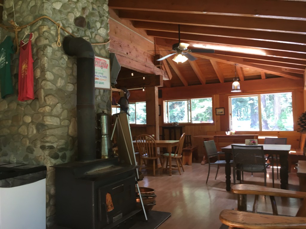
“Okay, I look alright.” I said to myself while looking at my picture by the sign to Lake Roosevelt National Recreation Area. It was a relief. I was not feeling well at all. I thought my relaxing time in Stehekin would be good for the body. It was certainly good for the soul, those two nights up in the forest in the most remote community in Washington surrounded by nature. Yet inside my intestines and my immune system were still angry. I felt as if I was entering that stage where my body was starting to reject food altogether. Anything I would eat would make me feel unwell, and I felt weak and withering. This was devastating to me at the time for a number of reasons, but especially because in recent years I had really focused on my health and building my body up. I was so disciplined and persistent with my daily workouts. I was very strict on my diet. My body was my most valuable thing in life. We should all treat our bodies as the valuable things they are, but I believe I had become over preoccupied with it. 

 I could see the natural process that played its course for me to arrive at such a place. I had spent much of my teens and young twenties very ill. Then my body healed. I regained strength and began to feel healthy after a long period of sickness. As my body began to once again absorb nutrients from food, it was exciting, and I held such an appreciation and gratefulness for my health. Slowly that evolved into being over-concerned and over-consumed with it. It was more about health too. It was also about building muscle and maintaining a certain physique. It was building an image and maintaining it. That doesn’t have to be a bad thing, but did I let that consume me, so as to lose my health now was unnecessarily devastating? This is what I was thinking. 

Now I felt like everything I had built was crumbling down. I was living to build my body. I had put so much value in that and now I did not have it. My muscle was withering away and I was feeling weak and ill. It was a punch to the gut that was already wounded…. But in the photo I just took I thought I looked good. I still looked healthy. I still looked strong. I certainly was feeling worse on the inside than I looked on the outside. Sometimes with ulcerative colitis, it is apparent when someone is ill, but it is also a silent illness, in that one can be very sick and feel utterly miserable but on the outside everything may look fine. 

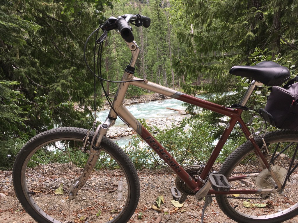
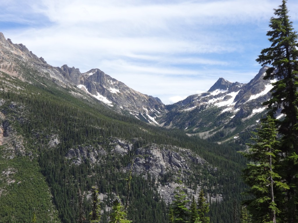
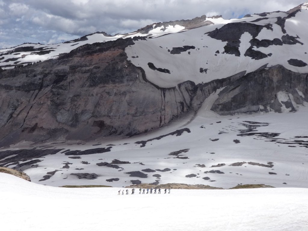
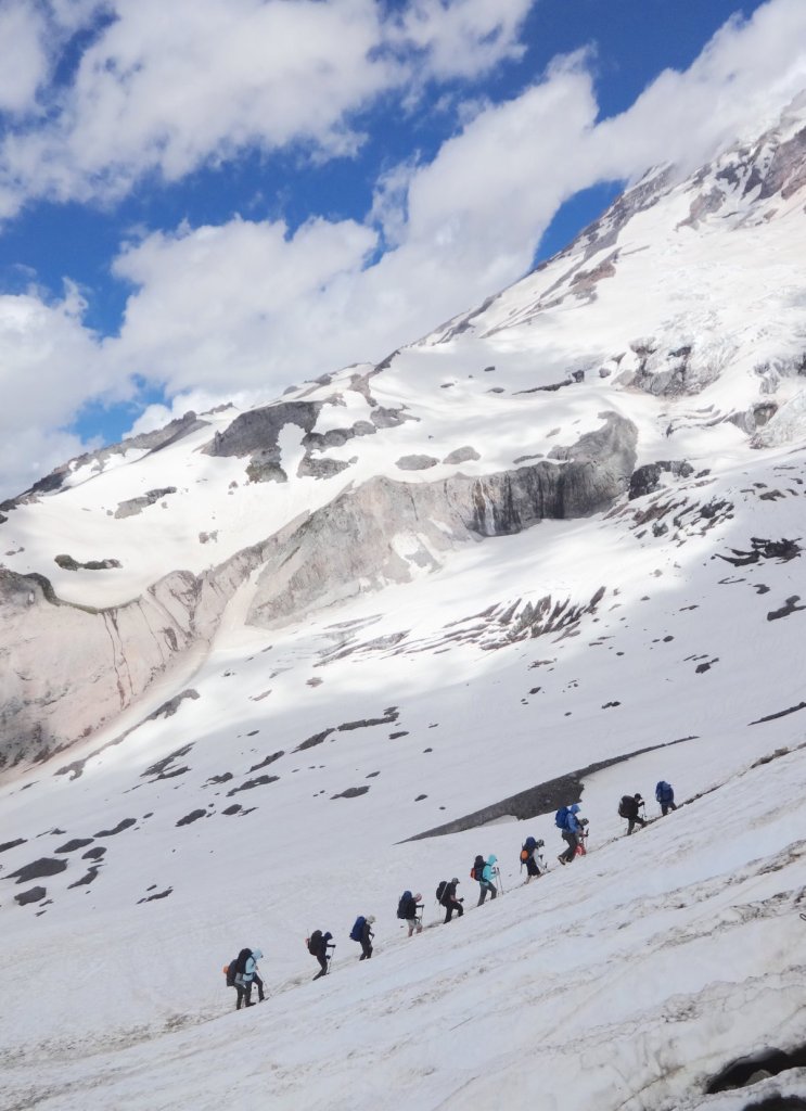
The photo I took gave me a little pick-me-up, for I was low in spirit. After the welcomed distractions of Stehekin and the excitement of exploring that little pocket in the woods the past few days, I had a three hour drive in which I felt miserable. My gut was restless and my body was fighting itself. I was pestered with the thoughts Why is this happening to me? And then No, this can’t be happening, but then I repeatedly was confronted with the reality that, Yes, this is happening. My thoughts would at times be distracted, especially by sights along the way- but then I’d feel the abnormal churning of the gut, an urgency to pull over, and I‘d have to repeatedly confront reality:  I’m ill. 

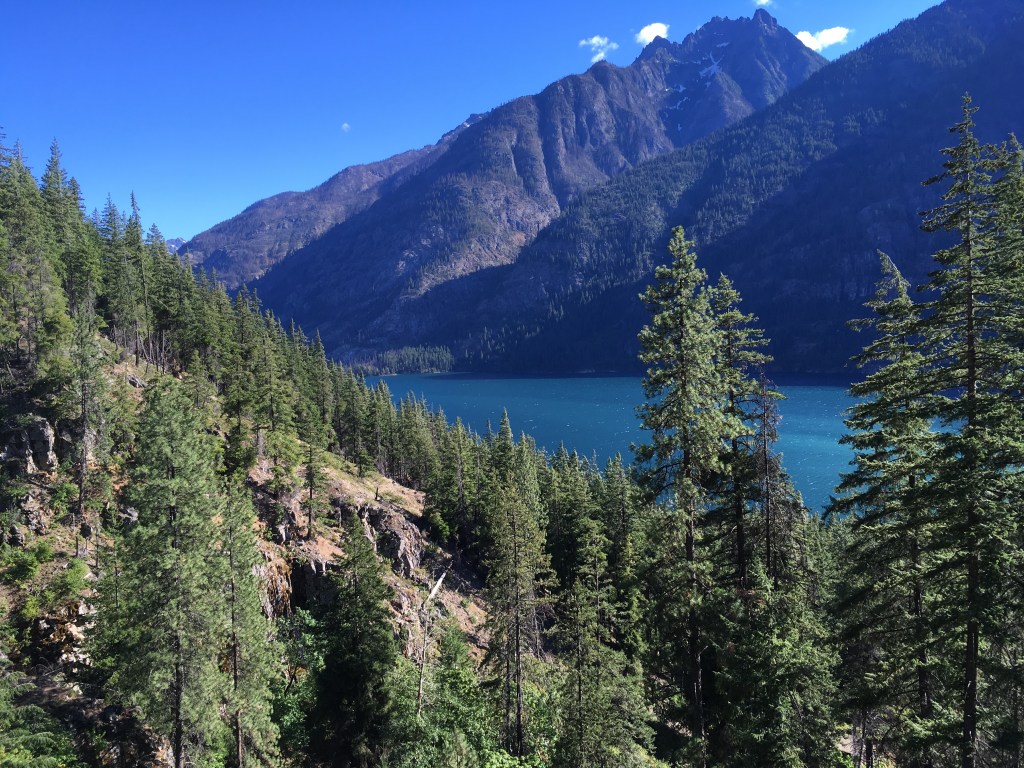
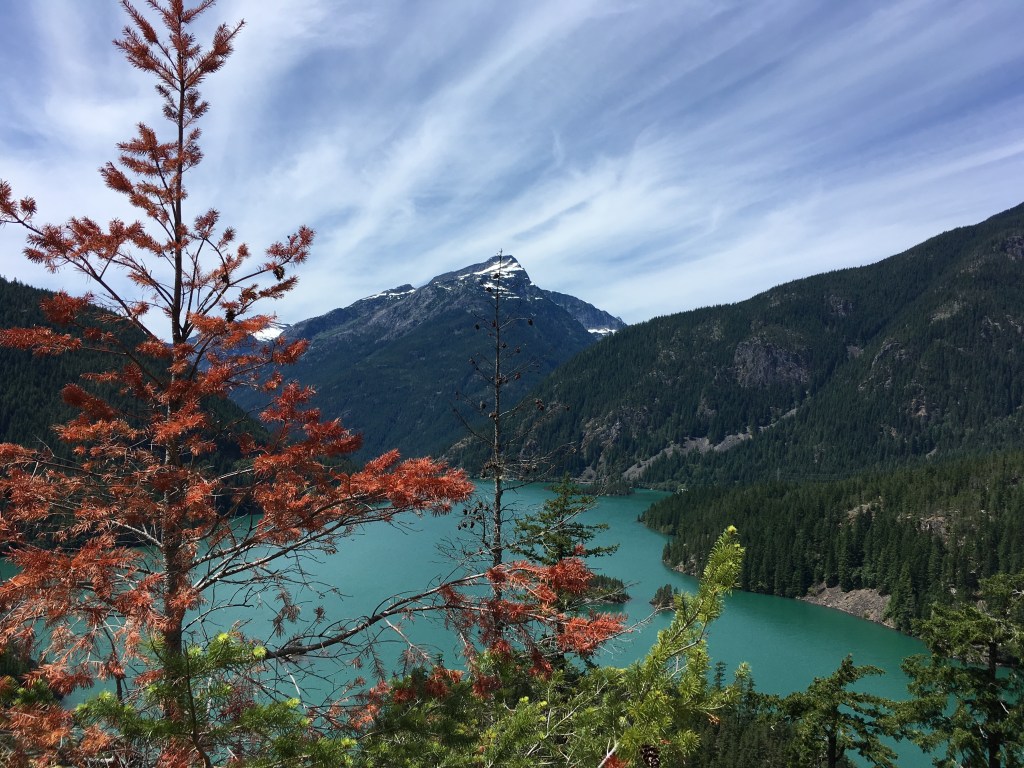
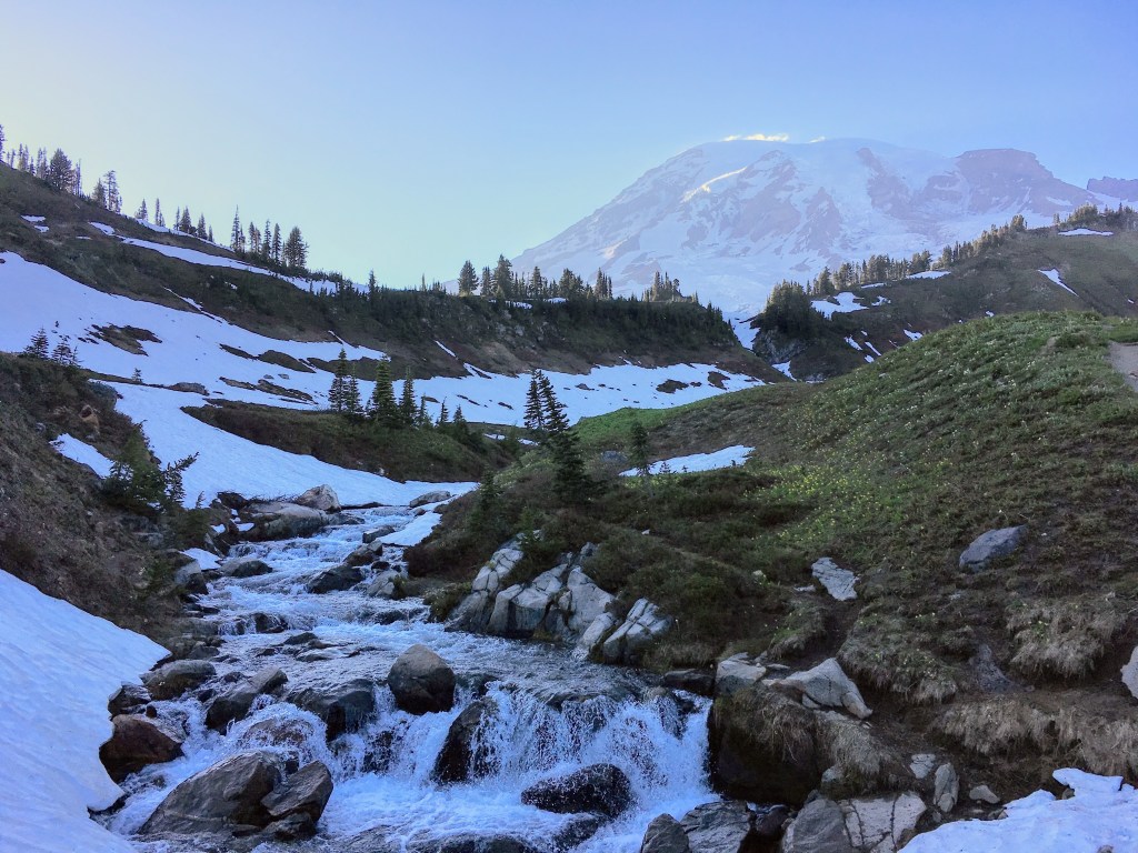
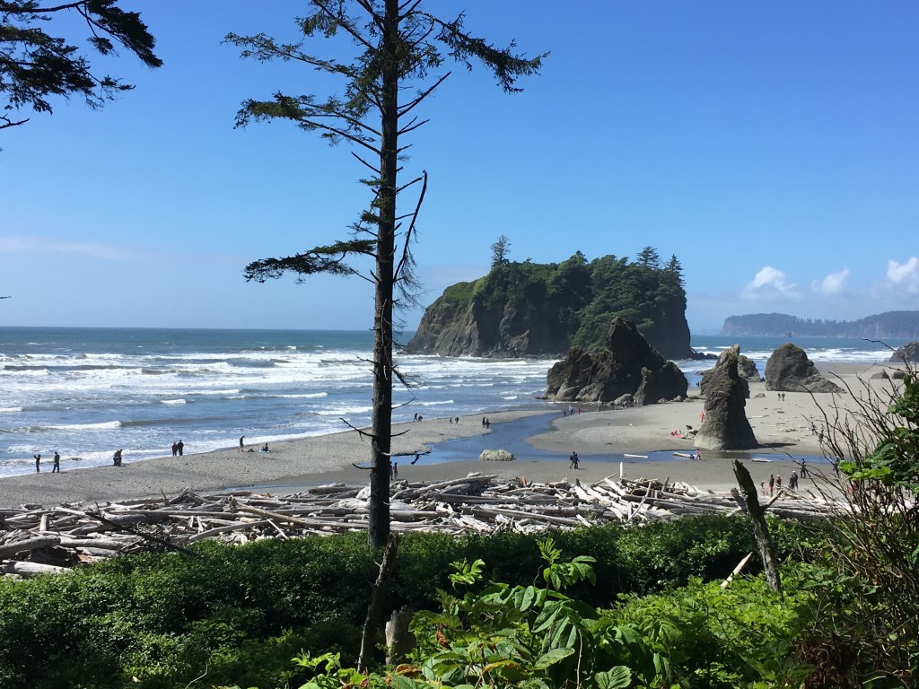
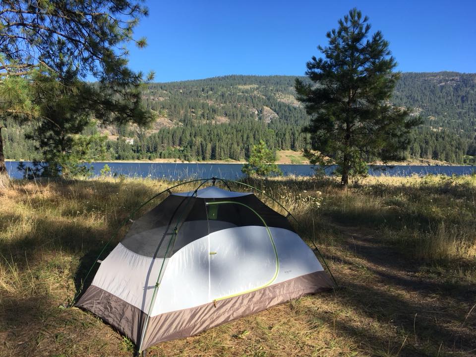
Eventually I arrived at Lake Roosevelt National Recreation Area. I had pulled over at one of the entrances to take my picture by the sign, something I try to do at every National Park Until. Feeling slightly better about my current state after seeing my photo, I pulled into Kettle Falls Campground. It was a very open arid campground. There were a few pine trees here and there, but mostly dry grass and dusty ground. I was atop a bluff beside the lake and on a rounded island very close to the mainland. As much as I love the deep forest, there is always something very comforting to me about wide open spaces. I think it’s the midwestern Illinois blood flowing through me. It’s calming for me to see the big sky and gaze over long distances, and there I could see that sky, and could look across the land over the lake.

Conservationists vs. Preservationists

Lake Roosevelt really is a part of the Columbia River formed by the Grand Coulee Dam created by president Franklin D. Roosevelt in 1941. I love natural places, and there is something extra remarkable about a beautiful lake naturally occurring in the wild, but there is something mildly disappointing about a dammed lake. I am not against dams. I think dams are fascinating in how much renewable energy they can provide and all the outdoor recreation they can afford. However  I am well aware that there are people who are completely against dams altogether and any human influence upon the land. When I consider these people, I know I differ with them in the type of naturalist I am. I believe I am a conservationist, which I would define as one who calls for responsible use of the land to maintain its benefit for further generations. This is certainly different from exploiting the land, for I have great reverence for the land. If we were to exploit it, we would rid it of all its benefits, rendering it useless and defacing its natural beauty. Rather I believe we conserve it, so we can have it for its benefits for generations.

 In some instances the best step we should take as conservationists is leave some things alone, preserve them. However my worldview is that the earth is designed for man’s benefit, and therefore we should use the earth for its intended purposes, and sometimes that benefit is simply in its beauty. An example is the Yosemite Valley. Don’t touch it. Let it be. It holds remarkable beauty. Other times the best purpose is for recreation or energy, perhaps that the assessment here for Lake Roosevelt. Sometimes the best purpose is agriculture, mining, cattle raising, farming, housing. Historically, the National Forest service has been a conservationist department, their motto: “land off many uses.” The National Park service is different in that its “to preserve and protect,” a largely preservationist mentality.  

The preservationist as an individual doesn’t believe in any human involvement with the land. They believe in leaving it completely untouched. They want preservation as is. A conservationist believes in preservation as well, but the preservationists doesn’t share the same view of land use as the conservationist. Historically speaking, I have great respect for both types of people. Theodore Roosevelt was a great conservationist and John Muir was a great preservationist. Together they accomplished a lot. I think the input of both, the challenging view of one upon the other is good to find a balance and approach situations reasonably. The conservationist unchecked could be corrupted into an exploiter of land, but the preservationist helps bring the conservationist back to his roots of mighty respect for the land. Also the preservationist unchecked can become an extremist, viewing the human as merely a hindrance to the planet, restricting his due duty to the earth. As a consequence the planet actually suffers. Unfortunately I think many have arrived at this harmful viewpoint today, or at least those with loud voices and showy influence have. 

Let’s take the example of forestry. It was once common practice for those working in forestry to attend to the forest. Fallen trees would be cleared from the forest and used for timber. This would benefit the man, but also benefit the forest as a whole. When lightning would strike and forest fires began, there would not be all the dry dead wood on the forest floor as ripe kindling, and therefore forest fires wouldn’t be as large and destructive. I know forest fires are natural and can be good things too, for the aftermath of a forest fire regenerates new growth and provides nutrients to the soil, but forest fires have grown bigger and more deadly, causing much damage, killing habitats, and disrupting air quality. People today want to blame out-of-control forest fires on “climate change,” but really the main factor is that in many parts, because of preservationists’ no intervention policies, forest floors are not cleared out of fallen timber. I see this as man not attending to his duty. Man in my view was created to attend to and take care of the land. He benefits from it, but he also takes care of it. 

Many preservationists of today are treating humans like an invasive species. Not only do we have man not attending to his duty to care for the land, but we also prohibit and restrict him in so many instances, which may not be necessary or good. I am so glad the infrastructure of our National Park system and the creation of all our beautiful National and State Park lodges and roads occurred at a time of the healthy pull of both sound thinking conservationists and preservationists. Today the preservationist would prohibit humans from all of what we have and enjoy in terms of parks. We wouldn’t have the richness of our access to these beautiful places. We have to be responsible but we cannot throw out reason. After all, this is ours too! 

Each Animal Has a Job

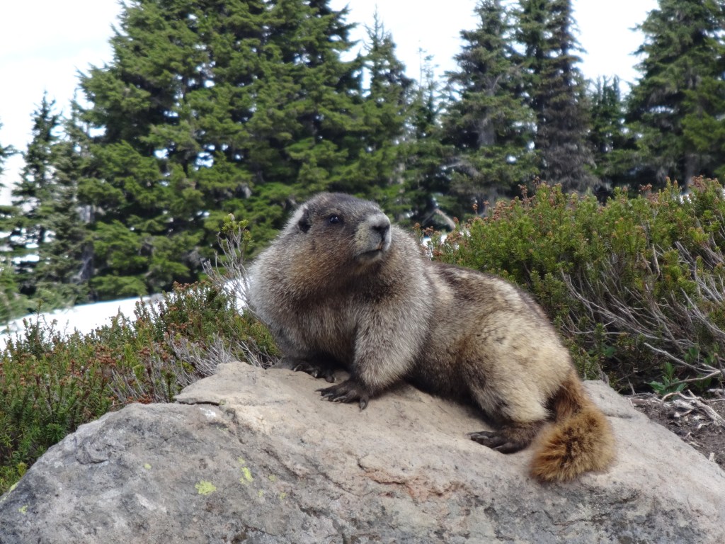
Take a look around the animal kingdom. All animals manipulate the earth. I think the strongest example is the beaver. They gnaw down trees, create dams as well, creating whole ponds and waterways that otherwise may not exist. They use their creations for their homes, their habitats, and cultivating their food sources. We don’t see huge movements and people taking to the streets to protest beaver dams now, do we? 

What about bees? They build these hives, enormous in comparison to their size, then they go around stealing pollen from all these flowers. Should they just let these flowers be? Should we regulate bees and restrict them from tampering with all these flowers? Should we place zoning restrictions on their hives? What would happen then? Well, there would be no pollination of our flowers. They would cease to reproduce. We’d have no flowers and would lose many vegetables and fruits to extinction. Also, bears feed off of beehives. 

Let’s talk bears. They have a responsibility to the forest too. They clean up dead carcasses and their waste spreads as fertilizer and spreads seeds to propagate growth of many plant species. Should we regulate bears and not let them roam free and confine them, for they are tampering with the forest by moving all those carcasses and spreading all their waste?

Man’s Role in Nature

Just like the bear and the bee God has given every creature its role. Birds build nests, bees build hives, beavers build dams, prairie dogs build entire underground towns, can’t the human build for himself a home or build his own dam? Every animal has a role with the environment. The human has a role too. The discussion should not be, how do we remove humanity from nature, but rather what is man’s responsible role in nature? Ignoring his role, the earth suffers. As written in the book of Genesis, God put man in the “Garden” to attend to it, and not to ignore it.  We should especially not ignore our forest and water ways in this great garden. We need to attend to them. 

This is not to say I am careless, but man is not an invasive species. I believe the earth is created for man. The bigger issue is that man doesn’t know who he is. The further we get away from God as a society, the less we know who we are; and the less we know about who we are, the less we know about our role and responsibility to the earth. 

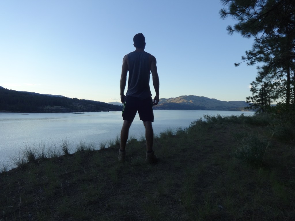
Here I stood at Lake Roosevelt. What do I make of this dammed lake? When it was constructed at the time of the U.S. coming out of the Great Depression and into World War II it provided much needed energy for the economy and today it provides great recreation. I acknowledge and have an appreciation for these things, but I also was a bit saddened learning more about it. Kettle Falls, the water falls which were a great and prominent gathering place for many Native American tribes of the Pacific Northwest to trade and fish along the Columbia River, was now flooded because of the dam. I was saddened that such beautiful things as waterfalls were eliminated by man, and I was sad considering tribes lost such an important location for them. When the dam was built and the falls were being flooded over, a number of tribes got together for a “ceremony of tears.” 

This site was also so important to their salmon economy. At one time the Columbia River was home to the world’s largest salmon runs with over thirty million salmon taking the route. The dam changed that. Oh, what should I make of Roosevelt Dam? Some things we just have to accept. There’s no changing. Things won’t go back. Kettle Falls are gone. The salmon run is not what it once was. Lake Roosevelt is here to stay, and so I have to approach it, not by the past, but in the present. Lake Roosevelt is unarguably beautiful. I chose to appreciate it and enjoy it.

Mission Point

I drove just a few miles up the road to Mission Point, a little peninsula on the lake where the Jesuits had formed a mission, beginning with the visit of two Canadian-French Catholic missionaries, Francois Norbert Blanchet and Modeste Demer in 1838. They witnessed to the Colville Indians and the fur trappers and traders of the Hudson Bay Company visiting the nearby Fort Colville. The following year they held the first recorded mass between the Rockies and the Cascades and baptized nineteen Native Americans. This was my first time learning of Catholic missions in the U.S.. I would go on to learn of many more on my travels through Montana. There at Mission Point was the old mission meeting hall. It looked like nothing more than a cabin. I walked around and read the interpretive signs. There was a small path that led out to the tip of the peninsula. I walked out there and sat down for a moment. Everything was still, calm, and quiet. The sun was setting behind the hills in the distance on the other side of the lake.  

On my walk back down the path to my car I spotted a deer. It was watching me through a window of pine trees in the forest. I paused and locked eyes with it, then I moved slowly and quietly towards it before it trampled off. 

Back in my tent I looked through the pictures I had taken on my phone and reviewed my itinerary. Tomorrow I’d arrive at perhaps the climax of the summer adventure, at what I was considering the National Park of all National Parks, Glacier National Park! 

If you enjoyed reading this, check out my book Still, Calm, and Quiet“

Check out my previous entry here: Stehekin Day 2: Pastries, Grouse, and Greatness

Visit www.joshhodge.com

Stehekin Day 2: Pastries, Grouse, and Greatness

 I woke up to the strangest, most intrusive sound in my campsite just aside my tent. I could not place this sound. I was so perplexed. It sounded like a drumming, but too soft and coming from too low-down to the ground to be that of a human. A gnome? An alien? That’s ridiculous!  It was so close, approaching my tent. This is bizarre. I rolled over and pushed myself up quickly to unzip my tent. There stood the funniest looking bird. I would describe it as looking like some sort of  wild chicken, but it was strutting with its feathers on full display and its chest puffed out, like a miniature turkey. It looked so proud and pompous, yet it was so small and ridiculous, especially with its little feather tufts sticking up on the top of its head like some punk-rock motorcyclist. It was trying to be tough, but had big curious infant-like eyes. My initial thought: What the heck is that? Upon locking eyes, his feathers shrank close to his body, in what I perceived as a reaction of embarrassment, and then he scurried off into the forest in fright. 

I had never seen this type of bird before, and I don’t know how I knew, but somehow it’s name was on the tip of my tongue. As I excited my tent and slipped on my boots, I kept trying to fish this word out of my memory. I was so close. I gathered my water bottle and my new book on Stehekin and threw them into my backpack. I began walking down the hill and it hit me: It’s a Grouse!…then, Is the plural form of grouse, grease?

This was day two of camping in Stehekin, the most remote community in Washington. My encounter with the grouse was midday. When I woke up and unzipped my tent for the first time of the day, I was greeted by the tall pines, the serene lake below, and the mountains standing mightily on the other side of the lake. My camping neighbor Luna Luu was already up as well, fixing things about her camp.

“Good morning,” I greeted. “Did you get some pictures of the Milky Way?” I asked. 

“No. I didn’t end up going. It was cloudy last night,” she explained. 

It’s what I had suspected.

This morning my first order of business was to go to the bakery for some breakfast. I invited her to come along, but she had her own hiking plans. After quickly throwing myself together, I hopped on my bike and took off down the road toward the bakery: Stehekin Pastry Company. The mountain morning air was brisk and refreshing, and there was no morning bustle about this place, as is common in so many places. Here the few people that were around eased into their morning. It was relaxing, moving at the gradual pace of the rising sun, slowly, growing with every passing moment gradually more alive. 

Opening the bakery door, I was bombarded with the enticing smells of cinnamon and coffee blended with all the other aromas of the fine craftsmanship of the Pastry Company. After camping outside in the cold northern night, biking through the brisk mountain air, I knew it was going to be so relaxing and perfect to sit down with a cup of something hot to drink and a great big fresh cinnamon roll dripping with house-made icing, while sitting by a window, glancing outside to watch the forest slowly wake up and be illuminated by the morning light. I sat there in peaceful bliss doing just so.

After a while I got up to browse the nearby shelf of merchandise. There were hats, stickers, and books. A particular book caught my attention Stehekin: A Valley in Time, the true story of the valley through the eyes of Grant McConnel, a man who lived here from the 1940s until the 1990s. I bought it, along with a sticker. I wanted to learn more about this place, and this book seemed perfect. I also noticed a number of other books, all by local authors. I realized this was somewhat of an author community. I understood why. The place was ripe for inspiration with its natural beauty, and its remoteness and solitude eliminates all the distractions for the writer. I would love to live in such a place and dedicate my time to writing. So far I’d imagined myself living here as a baker, then a teacher, and now an author. I had no idea that in less than a year I’d find myself spending my whole summer on the edge of Glacier National Park, in the remote community of Polebridge, sandwiched in between parkland and national forest in the wildest river valley in the lower forty-eight states. There I’d live and work amidst the beautiful Rocky Mountains, off the grid, in the beloved Polebridge Mercantile and Bakery. I guess we could say it was a dream come true, looking at the dreams occupying my mind during my time in Stehekin. When I was interviewing for the job in Polebridge over the phone in the winter- the owner told me how he wanted to place me at the front of the store as a closing cashier. In that moment, and in fact all-through the interview, in my mind I kept seeing the Stehekin Pastry Company. It was my only point of reference to such a job. I recalled seeing the bakers back in the kitchen with their mounds of dough, working so diligently but seeming to have fun. “What about putting me in the role of a baker?” I asked. The owner, Will, explained how he believed that with my skill set as a teacher I’d be best suited for the front of the house. He was right. He told me that if things work out he’d like for me to keep a relationship with the business and return for more than just a summer. I worked there for many summers and continue to do so. My time working at the Polebridge Mercantile and Bakery are some of the richest of my life. Although oftentimes rustic and primitive, it’s my summer paradise. I love it!

After my morning cinnamon bun I got back on my bike and traveled non-stop to the other end of the road, past all the sites I had stopped at the day before: the one-room schoolhouse, the two-room schoolhouse, Rainbow Falls, Stehekin Ranch, and then bearing off the main road I rolled down a path to the Stehekin Airstrip, a field amidst the pines. Is this really an airstrip?…I guess it would do. I could imagine a little private plane landing and rattling atop this field. I supposed boat access wasn’t the only way to arrive at Stehekin but plane access had to be private. There were no commercial or charter flights. Biking past the “airstrip” I sought out “The River Trail,” from my map. When I parked my bike against a tree and started on the trail I realized it was not a very frequently trafficked area, for it was mostly overgrown and had just a narrow space barely big enough for my feet. My ankles were brushing up against the growth of the forest floor. This was a rich lush forest, more characteristic of those back East. At one point the path came close enough to the river I could see the water. At this location I’d call it more of a creek than a river. I veered off the path and stepped down onto the river bed. It was so shallow the water didn’t even reach as tall as the top of my boots. The water was also not high enough to cover all of the riverbed. The middle of the river was dry, so it was there I sat down. With my eyes closed and listening to the trickling water around me, I prayed a prayer of thankfulness for being here. I also prayed about my health. I had enough distractions from all I was seeing and experiencing in Stehekin that I hadn’t been focusing on it, but it was still, in its own aching way, always present on my mind and felt in my weakening body. 

This is good for me, I thought, to relax by the river, to take in the soothing sounds of the water and the lights beaming through between the tree branches. This was a gift from God. I had been feeling that my body was caught in this state of high tension and if I could get it to calm down, escape this state of being, I’d be okay, but it felt like a lot to do. I was up against my very self. I concluded every moment should be used to help bring my body out of this state of tension. This was one such moment. Relaxing was now a priority of mine. In my relaxed state I broke open my journal and began to write.

When I got back on my bike, calmed, settled, grounded into this time and space, I leisurely began biking back to the other end of the road. Of course I had to pass by the bakery again, and it was time for lunch. I was hungry and there were many great things on the menu for lunch. I couldn’t make up my mind of what to order so I just decided to buy two lunches, a salad with salmon and a roast beef sandwich. They were delectable- especially the salmon. I thought it was fitting to eat salmon in the Pacific Northwest. Once back in “town” I realized it had been about twenty four hours since I had rented my bike, so it was time to turn it in. Then feeling mildly handicapped without my wheels, I walked back up to my campsite. It was time for a nap. It was only afternoon, yet I had already covered great ground this morning and felt it was fine to give up some of my day to sleep. After all, relaxing was now a priority. I fell into a deep sleep in my tent, wrapped in this fold of nature, and then I woke up to the drumming grouse just outside my tent. 

I ended up spending a large portion of the evening sitting on a rock up on the mountainside behind the campground, looking down at the lake. There I read the book I had bought about Stehekin. It was a very entertaining read. Between this evening and the following morning I read the whole book. That’s very fast for me. It was that good. I especially enjoyed learning about the community back in earlier times. I read how delivering mail along the stretch of road was a shared responsibility. People took turns. In the winter, the author delivered the mail on skis. It was customary for him to stop by and visit with everyone along route. It sounded kind of nice, skiing out in the cold of winter, stopping occasionally every few miles, stepping into a warm house with a warm fire in the hearth, greeted with a cup of coffee or tea, and engaging in conversation about the latest news of the valley. It also stuck out to me the part discussing how there was only one phone in Stehekin in the post office brought in by the National Forest Service. That was the only immediate communication to the outside world, and it wasn’t very reliable. It also struck me as comical, the part about the aftermath of a  plane crash up in the woods, and how the locals, given they had very limited resources, stripped that plane and used it for building materials in their homes, and even parts of it was used for dinnerware. Remnants of the plain could be seen popping up all over the community in people’s houses. 

The author talked about how for so long Stehekin was frozen in time, and a unique and very personal community. Whenever someone had to take the boat down the valley into Chelan, people were often repulsed by the chaos and lifestyle of those “down lake.” Reading this book, everything seemed like such a far-off, foreign, yet intriguing concept. However, later in my own time working at the Polebridge Mercantile and Bakery in Montana, I would live through similar experiences. It too is, at this time,  a one phone community. The contrast between our life up the North Fork River valley couldn’t be more stark against the developing society down stream.

The following morning, day three in Stehekin, it was time for me to go “down lake” back into the real world, but I wouldn’t be spending much time in society. It was time for the next leg of my adventure and off to other wild places, soon approaching the behemoth of National Parks: Glacier National Park. Before I boarded the boat I walked to “The Garden.” This morning the gardener was there. From my understanding this was all his. I bought from him some sugar snap peas and cherries. I stood there in the garden and spoke with him for a few minutes. He told me some of his story and how he ended up here. To me, at the time, it struck me as sort of weak, running away from society and life’s problems to live up here in remoteness. I had perceived it as a negative thing, but with the evolution of society “down lake” and after my own experience living in a similar remote community, I have grown in perspective thinking back on his story. There is a healthier way of living that is lost in the bustle of growing society. I get it. 

Back on the boat, I was munching on my delicious sugar snap peas, so sweet and crisp, mixing things up every-so-often with a nice tart juicy cherry. This is going to be good for me, I was thinking, for my body and fighting the inflammation I was feeling. Some nice fresh produce, a few days in Stehekin with moments of great relaxation, and now sitting in the sunlight on the open water is going to make me just fine, I thought. My ulcerative colitis was just some strange nightmare. I’m going to put this illness behind me. It’s over. I’m okay now. 

I was wrong, very wrong. This was only the beginning. Things were going to get much worse… and much more beautiful. 

If you enjoyed reading this, check out my book Still, Calm, and Quiet“

Check out my previous entry here: Stehekin: The Most Remote Community in Washington

Visit www.joshhodge.com

Traveling Across North Cascades National Park

I got an early start because I had slept in the car. There was no deconstructing the tent and packing up. I was ready to go. I went from sleep to the turn of the car key and I was on the road. Now it was time to pay a visit to another National Park: North Cascades National Park, which was only about an hour away. When people refer to the North Cascades, it’s similar to when referring to the Redwoods. As the Redwoods constitute a collection of state parks, North Cascades too is a collection. There are three major entities: Ross Lake National Recreation Area, Lake Chelan National Recreation Area and North Cascades National Park proper, though the latter name is just used to refer to all in the trio collectively. 

I had big plans for this visit: an overnight backpacking adventure the following day in the Lake Chelan area. Today I would just be traversing the heart of the parks on highway 20, stopping at the visitor center, all the overlooks, and seeing what I could see. I had noticed in my investigation that all the iconic views of North Cascades were roadside viewpoints, so I figured I wouldn’t be missing anything essential.When visiting parks I’ve got to make sure I don’t miss out on the essential views. What a shame it would be to go to Yosemite and never see Tunnel View, or go to Yellowstone and fail to see Old Faithful.

My first stop was at the visitor center by the west entrance of the park. There I watched the park film, and a series of other films on smaller screens throughout the visitor center. The three National Park units that make up this area were all created in 1968. This park has glacial mountains, consisting of over 300 glaciers. Although it’s famous for its sharp mountainous peaks, called the Cascades, it got its name North Cascades, and I suppose the mountains too,  from all the water cascading from the peaks, forming many streams and rivers. The water sources of the area were used for hydroelectric power, but the development of the National Park stopped the further industrial development. The park’s two most famous lakes, Diablo Lake and Lake Ross, are the result of man-made dams. Both lakes are extravagant in their bright turquoise color, which is created from rock particles. The National Park Service describes it best: “the distinctive turquoise color of the lake is the result of suspended fine rock particles refracting sunlight. These rock particles, called glacial flour, enter the lake when rock from the surrounding mountains is eroded by ice and flows into the water through glacial streams.”

After learning about everything in the visitor center, it was time to experience it all first hand. About ten minutes up the road I made my first stop. Nestled closely by mountains on either side, within a gorge, and right along the Skagit River,  was this little town with modest homes and a few small businesses. It was strange to see manicured lawns, and intentional landscaping around buildings in a National Park. The only other thing it reminded me of was the town of Mammoth Hot Springs in Yellowstone, where many park rangers and staff take residence. But this town looks rather industrial with lots of electrical wires and utility infrastructure. I know this had to do with the dams and hydroelectric power, but it didn’t even cross my mind that the waterways in this park were still being used to generate electricity. I had assumed this was all a relic of the past, that it was a company town of a hydroelectric power company but the homes left over from that bygone era were now ranger residences. I thought this was a little ranger and park employee village. I’d soon learn I was wrong. The town of New Haven is surrounded by federal National Park land, but this mile long community is owned by Seattle City Light, and all the residents of the town are exclusively employees of Seattle City Light, working on the Skagit River Hydroelectric Project, a series of dams and hydroelectric stations. Altogether this operation provides about 90% of Seattle’s electricity.  I was surprised to find a currently operating utility company stationed within a National Park. Operations of the hydroelectric project began in 1924 with president Calvin Coolidge formally initiating it all. With The National Park designation coming more than forty years later. I suppose the value of the hydroelectric power was too valuable to eliminate. I’m sure there is quite an interesting and complex relationship between Seattle City Light and the National Park Service. 

In town I wandered around a bit, reading a few historical placards. Prior to World War II this town was quite a tourist destination. The tourists would come in on a twenty-three mile train ride, stay in the Gorge Inn, and go on tours of the Hydroelectric Project on boats. It was quite a thing to see. But after the war it lost its status as a tourist destination. 

There in town I saw an old steam engine on display, and crossed a suspension bridge, and I bought a brown sack lunch at Skagit General Store. This town wasn’t particularly charming or quaint. It wasn’t rustic, and it lacked any defining character. The proximity of the mountains and river were its most prominent features, but it wasn’t trying to be a tourist destination anymore, for it was only a functioning company town. The city dwellers need their electricity. I wasn’t expecting this but I learned that hydroelectricity is a part of the experience when visiting North Cascades National Park. 

Just a little bit up the road I passed a dam, one of a series, but this one was the most visible and creatively named “The Gorge Dam”. It had to be old. Observing the architectural design of the powerhouse, you could say, “they just don’t make them like that anymore.” It was designed with attention to the image it would portray. It was a work of art. Not knowing much about architectural terminology, I would say it was a fusion of Roman and Art Deco design. It had long rectangular windows and boxy features with a regal boldness and pillars. 

Suddenly everything changed past the dam. I was back in the National Park, and back in nature’s beauty. I was a little disappointed, at the time, to learn that the lakes of the National Park were not natural but were the result of dams. Don’t get me wrong, I love a good dam, and I admire human ingenuity to harness power through water, but to know the National Park was not all natural just kind of tainted it a bit in my mind. The only dam I wanted to see here was a beaver dam. Of course if a beaver dam is a part of nature, then isn’t a human dam a part of nature too? Is man himself not a part of nature? 

As I continued my journey on the park road, climbing upward in the mountain reaches, I made my next stop at the overlook of Diablo Lake, and oh my! What a sight! Pristine! I was surprised to see that such a vibrant turquoise color could even exist in nature. It was such a bright and vibrant color. Although perplexing, in its surrealness, it yet looked so natural and believable. Mountains dramatically sloped down into the milky turquoise water, which curved around into many bays. To the right side of the lake, before the inlet of a bay, stood two small little islands. The middle of the lake spread up to the foot of Davis Peak, a jagged snow-capped mountain. From behind the mountainscape delicate clouds wisped forward, as if imitating beams of sunlight. The dark richness of the pine forests on the mountainsides, contrasted with the turquoise lake and the blue sky created a unique pacific northwest color scheme. There at the overlook I also noticed a pine tree whose needles were turning red. It was probably a sickly tree, but in my photos I was able to add a splash of red, creating such a colorful capture. From here the mountains were dramatic and tall, but there were only a few to behold. Mountains didn’t stretch on in layers in the distance. Only the immediate ones were seen, giving the accurate impression that I was up very high. All other peaks were below and hidden. Only here could I see the highest reaches and I did feel on top of the world. 

Just a few miles up the road I also came to an overlook for Ross Lake. It too was stunning. It was similar in color and nature to Diablo Lake, but much longer, and the way the mountains were situated and the lesser number of immediate bays, made it just the slightest bit less picturesque, but still beautiful and magnificent nevertheless.

The rest of my drive provided great views of sharp craggy peaks, jutting up from the mountains, as if mountains were upon mountains. These weren’t rounded or flowing mountains but dramatic sudden reaches. And they were immediate reaches, right there, with snow caught in their veiny rivets. There was a definite character to these mountains, and if these mountains were music, they’d be crescendoing cymbals of a regal nature. It’s was if I could hear the mountains. I stopped at one overlook of the mountain valley and beheld the mountain peaks beside me, so tall. It was truly a moment of awe, and I thought, I’m back. I’m in my element. The awesome wonder that beset me my first great summer adventures is here to recapture my spirit. The sense of adventure was on fire again, a blazing campfire, with sparks igniting the night sky. I was coming back in my spirit to a place I so longed to be. 

About twenty miles outside of the park I arrived into the town of Winthrop, Washington. None of the campsites in the National Park were reservable online, and planning my trip I wanted to have the security of a place to stay. I wasn’t sure how busy North Cascades would be. It didn’t prove to be very busy at all. Arriving in Winthrop, I was surprised. The land was very arid. There were hillsides surrounding that were very dry and barren. I could have been fooled that I was in a desert of the Southwest. I had never before associated the desert with Washington. On the way to the KOA I drove through the little downtown. It was a quintessential Wild West downtown of not just Western facades, but the real deal. Nothing was too bold or boisterous but rather small and charming. The businesses beheld names such as “General Merchandise,” “Emporium,” and “Saloon.” A vintage but functional gas station with two pumps sat next to the road where people walked on the sidewalks. I realized this place was a tourist draw, but not overly so. It wasn’t crowded. It wasn’t flashy. It was just right. After being in the remote, brisky north reaches of the Cascades, it was comforting to be in this warm little welcoming Western frontier town. I’d later learn that Owen Wister, the Harvard roommate of one of the original settlers in the area, Guy Winthrop, wrote his famous Western novel, “The Virginian”, after a visit to Wintrhop. 

The KOA was only a mile from the downtown stretch. I drove across Chewach River, noticing a bike path parallel to the road and also crossing over the river which was shimmering in the evening sun. Everything around here looked well taken care of. Right next to the entrance to the KOA was a long wooden western style building named “Winthrop Dry-Goods.” Perfect! I went inside the small grocery store and bought some yogurt, Frosted Flakes, and milk. 

I checked into the KOA, and it was so nice. It sat right at the Methow River at the foot of a desert hill. I had reserved a camping cabin, which had plenty of space around it, and I felt like I had so much space to breathe in this nice dry, warm, and welcoming place. I took off my boots and trod around barefoot. Relaxed, I organized the trunk of my car. Now that Zach was not here, I had full reign. I also did a load of laundry, and packed for my upcoming backpacking trip to Stehieken. While the clothes were spinning I took a warm shower in the nicest KOA bathroom I have ever experienced. When I checked in, the hosts even bragged about how new it was. It was a log cabin style building and inside there were about a half dozen little individual private bathrooms. Each had their own shower and little changing area separate from the sink, mirror, and the rest of the bathroom. They also each had their own skylight, letting in warm sunlight. They all had that nice new building smell, but not just any new building, but a fresh-wood log cabin smell about them. 

When I gathered my laundry and went back to the cabin, I noticed a few items hadn’t dried completely, so I laid them out on the railing of the porch. I then poured myself a cup of Frosted Flakes into my KOA cup from the night before and reveled in the sweet crunch, as I sat on the porch swing, updated my journal, and read a little bit of John Muir. This was a simple yet blissful moment. 

I then drove back into town, first stopping at the cable bridge alongside the bike path to cross over and look down into the river. In downtown I parked my car and walked down the mainstreet. There wasn’t as much to see as I expected from the initial perception driving in, but it was all pleasant. I ate dinner in an old turn of the century schoolhouse, rightly named “Old Schoolhouse Brewery.” I had a chicken sandwich on the back porch overlooking the river. 

Back at my little cabin, at great peace for a quite a productive evening, and after having a day full of great vistas and travel, I slept soundly, anticipating the adventure that lay ahead: backpacking into Steheiken. 

If you enjoyed reading this, check out my book Still, Calm, and Quiet“

Check out my previous entry here: Strange Faces, Strange Places

Visit www.joshhodge.com

Skyline, Longmire, and My Walk of Shame

More snow, more glacier lilies, more flopping marmots, more blue sky, more wandering mountain streams, more astounding views–  they were all here. It was day two at Mount Rainier National Park in Washington state, and Zach and I were on our way to Panorama Point. This point was not on my itinerary for the day, but much had been shifted and changed. For the most part, my printed itinerary was ignored for this leg of the trip, and we were just feeling it out. I wasn’t going to stress about it either. I was learning to be more career free, trying to lessen my level of stress and go with the flow, as I was still concerned about my health. So once arriving at the park and observing the maps, a trail named the “Skyline” trail reaching a “Panorama Point,” stuck out to me. I figured places with such names would surely deliver satisfying views.

As we started off on the hike, we had to leave from the Paradise hub of the park and hike past Myrtle Falls again, which we had seen the evening before. The entirety of the hike was uphill, and “hill” is quite an appropriate term to describe the terrain although we were on a mountain side. For this mountside was composed of various hills and was a very wavy landscape. We’d round one hill, and the incline would lessen greatly for just a moment, and then we were traveling up another. The path we were on had been trodden enough that for the most part I could see the path clear from the snow with its natural gravel surface. Much of the trail was also outlined with rocks, but surrounding us, apart from the beginning meadows of glacier lilies, we were surrounded by snow. Slowly but surely we climbed higher, and Paradise was becoming smaller behind us. Reaching the higher snowy elevation of the hike, I noticed a giant gray rock canyon carved to our left by a glacier. The glacier was no longer there. It had melted down into Paradise, but its pathway was clearly visible. 

The most astounding view of the trip was not the actual Panorama Point but when out in a fair distance beside us, on the snowy sloping landscape, with a giant rocks wall behind them, and glaciers looming over them, trekked a group of mountaineers. They were traveling all in a line, as in a train pointed upward diagonally. Each mountaineer was bundled up with winter gear: hoods, gloves, and large packs on their backs. They all had trekking poles, and it was obvious they were on their journey to summit Mount Rainier. The view of this train of mountaineers, so tiny and miniscule compared to the immensity of the mountain, added great perspective; and considering the notion they were on their way to the mountain peak on an impressive journey, sparked in me an exciting admiration for adventure. To be in their presence, if just for a moment, and yet at a distance, helped create this climate of sheer adventure! I wanted to summit Mt Rainier too!…but not this time. 

When we reached Panorama Point after about three miles, there was a leveled area of gravel, outlined with rocks like the path was. It was also fenced in with a steel cable strung between some stakes. The Park Service didn’t want people on this trail going beyond this point obviously. From here there was a 360 degree view. Looking southward, the main attraction of the point were the sharp peaks of the Tatoosh Range. Although still quite grand in their rugged and sharp attire, they looked like miniature Tetons. From Paradise, the Tatoosh mountains stood tall, but from up here, we looked about level to them or down upon their peaks. Here we could also look down and see the Paradise Inn and the whole village far below. Here the marmors were trying to steal the show and grab everyone’s attention, posing majestically in the most dignified and stately ways, as if suddenly ignoring their rather goofy nature. 

Turning to the east were many layers of mountains far in the distance, stretching on in immensity. They were of various dark blue shades. The closer ranges appeared darkest and the further ones lightened up just slight enough to create a contrast, and thus I could see there were four layers of mountain ranges on display, one in front of another. Behind us, to the north, was a mountain on display as well. First was a snowy stretch of mountainside, but behind it stood the mighty Mount Rainier ever so boldly with its crumbling glaciers. Completing the 360 panorama and turning to the west, two main features came into view: The entire glacier rock canyon I had seen climbing up was in prominent display, as a gouge or scar on the mountainside, and then next to it, down in the depths of a valley, was the Paradise River, snaking around the forest. 

The views were nice, but I believe better views were seen elsewhere in the park. The greatest highlight of this hike was not in the views but was in the journey back down to Paradise. We decided not to complete the entire loop, as it would be a little bit longer and we wanted to preserve time to see some other places in the park, so we went back the same way we came… sort of. This time we did not stick to the path at all. Instead we slipped and slid down the mountainside, surfing all the wavy declining hills. We did so standing up on our feet. There was such a lack of friction between my boots and the snow, and such a perfect uniform slippery slushy icy consistency of the snow, that I was speeding down this mountainside. I’d launch myself forward and see how far I could keep the momentum. It was reminiscent of sliding across the newly polished wooden floor in socks as a kid, but here we were sliding down over great expanses, and it was exhilarating! I was surprised at the physics of this occurrence in that it was even possible. The fun icy descent had us back in Paradise in no time. 

After a quick stop in the cafeteria for some burritos, we were back in the car. At eleven miles west on the park road, we stopped at Longmire, a historic section of the park with tales to be told. Here was a small flat prairie, surrounded by trees, and somewhere tucked away were mineral springs. This was the site where a man named John Longmire and his family had a homestead in the 1800s. It is also here where the Longmire’s opened a mineral springs resort. People with all sorts of illnesses came from all around the country to stay at the Longmire’s hotel and soak in the mineral springs. It was believed the waters had healing properties. Even doctors would prescribe patients to soak in these springs. Where are they? I questioned. I need to find them. Maybe the springs can heal my Ulcerative Colitis. It was unlikely but I was willing to try anything. If only I was here about two hundred years ago. The closest thing I found to a spring was some sort of water source pooling in bright orange. It very much resembled the leakage of abandoned coal mines I see in the forests of Kentucky, but it was likely the minerals of the spring oxidizing and changing color…It was not very appealing. 

In this Longmire area was also a short path called the Trail of Shadows which traced a meadow, which next to stood a small collection of historic buildings from the Longmire’s resort days. They were all built in the rustic National Park Architecture style. The Longmire’s hotel today stands as the functional National Park Inn. Next to it was an old rustic gas station and “comfort station,” as they called it back in the day, with a tall stone foundation and an overhang with two old gas pumps that were probably once just more gas pumps in the wild.  Another building that used to be the park headquarters is now a small museum on Longmire. It’s most fascinating feature to me were some antique taxidermied animals. Maybe it was their age or the way they were poorly put together, but to me they were funny, especially this taxidermied pine marten flaring its nostrils and showing its teeth, very territorial. As we meandered around the Trail of Shadows, at one point we veered off onto an unmarked path. We ended up crossing a suspension bridge and found a village of unmarked cabins. These weren’t on the map.  There seemed to be one central building among them. We walked inside just for a moment, for I quickly realized we weren’t supposed to be here. There were couches, tables with board games, and a kitchenette. This was a part of a staff lodging complex. I concluded. It was like a community center. How cool it would be to work in a National Park for the summer, I thought. What a foreshadowing moment. 

Just a couple miles up the road in the park was our campground at Cougar Rock where we had spent the night the night before. I thought of taking a break, hanging out at camp, maybe relaxing in the tent, perhaps doing some reading, regrouping and planning the rest of the evening. Our campsite was number 20, so there was a bit of slow driving through the campground to get to our site. When we arrived I was stunned to see our tents were not there. Someone else’s bright orange-colored dome tent was there instead. All our stuff was gone! I was completely taken off guard. Did someone steal our stuff? Did someone rob our campsite? How dare they! What a nightmare! I got out of the car for I was going to confront these imposters, but no one was there. The feeling of offense grew stronger. Then I looked to my right. Our tents and all our camping gear had been throw alongside the campground road. The audacity! Then I vaguely remembered something. I think at one park we are to switch sites in the midst of our stay… It wasn’t this one, already, was it? I pulled out my itinerary. I wanted to prove my suspicion wrong and reclaim my site with my reservation documentation. I unfolded my itinerary, and embarrassment immediately set in. I was the one at fault. We were the trespassers. We were the squatters. We were the offenders. We were at site 20, but we were supposed to have moved to site 2. I was embarrassed in front of Zach, to myself, and to whoever else might be in the campground watching us. We got back in the car and I drove to site 2. It wasn’t that far, only 18 sites away. I didn’t want to deflate my air mattress and deconstruct my tent, pack it in the car,  only having to reassemble everything. Instead I decided to take a walk of shame, picking up my tent with the air mattress and all inside it. The tent floor was sagging greatly as I was walking it down the road to our new site. I succeeded at trying not to notice anyone else around me, for my head hung low in shame. Back at the tent I situated everything in its place, and carried on, hoping to blend back in among the other campers in the campground. 

I don’t recall what Zach was up to at this moment. I was probably too inner focused on my own embarrassment, but when camp was reassembled, I proceeded to seek out some firewood to purchase for a fire we’d have at night to cook our soup, and I rested my head in my tent and read some more of my book on wolves. After a brief rest, we took the short trail from our campground to Carter Falls. The trail was a 1.3 mile segment of the Wonderland Trail, which in its entirety is over ninety miles. We rushed along the path beside Paradise River to the falls, which spilled down from about fifty feet in height. It’s described as a “horse-tail” falls, but the falls splits in two over a protruding rocks, near its top, to create almost two  side by side falls. So I guess its a “horse-tail” falls if the horse has two tails.  It was a pleasant fall for such a short hike from camp, but nothing to really write home about. It reminded me much of a fall I’d seen in the Great Smoky Mountains. 

After our quick visit to the falls, we drove back to Paradise. I wanted to hang out in the Paradise Inn again like we did the evening before. There was a balcony up by the rafters in the eves of the roof with wooden desk and warm lamps. I bought some hot tea from the inn’s cafe and a few more postcards. I’d fill them out as well as update our happenings in my journal. When I went to purchase my postcards I also bought a green bandana that itself was an artistic map of the National Parks of the Pacific Northwest, of Olympic, Mount Rainier, and the North Cascades. It was a perfect souvenir covering all those parks. 

When night set in, we headed back to the campsite, and this time our tents were still there. Phew! I started a fire. I peeled the label off my can of soup and opened its lid. I set it just aside the fire. It was time for supper. This would be the concluding night of our stay in Mount Rainier National Park. This was also the last full day of Zach on this summer’s adventure. The next day, as planned, I’d take him to the airport in Seattle to travel back to Kentucky. Though this leg of the adventure was over, I had much still before me as a solo traveler. I would go on a backpacking adventure in North Cascades National Park, venture on to Lake Roosevelt, and would make my acquaintance with the national park of all National Parks: Glacier. My health was also about to take a turn for the worse. I’d struggle physically, have to come to terms with reality, learn how to accept it, and find the resolve to carry on amidst hardship. 

If you enjoyed reading this, check out my book Still, Calm, and Quiet“

Check out my previous entry here: “Mount Rainier: the noblest of peaks”

Visit www.joshhodge.com

Mount Rainier: the noblest of peaks

“Of all the fine mountains which like beacons, once blazed along the Pacific Coast, Mount Rainier is the noblest.” – John Muir

Cars were backed up to get into this park. I could see just a little bit up the forested road to the entrance gate. There a large wooden sign hung down from a rustic pine log which laying there, propped up by other pines on either side, had constructed an archway- a portal into the park. Its letters were all upper-case, bold, and carved simply into the sign. The grooves painted white displayed “MT. RAINIER NATIONAL PARK.” 

This was a top tier national park, our nation’s third behind Yellowstone and Yosemite, created in 1899 by President William McKinley signing a bill passed by Congress. This park is named and centered around one mountain peak, but deservingly so. MountRainier is a giant at 14,411 ft. It is  visible throughout most of the state of Washington and has the most glaciers than any other peak in the contiguous United States with a whopping total of 26 glaciers. We had seen this mountain much earlier in the day, traveling from the Olympic peninsula around Tacoma. It was a magnificent bold giant standing in the distance. Over the course of hours we noticed it growing bigger as we drew closer to it. Now we were at the mountain’s base about to enter the National Park!

Once officially inside, passing beneath the enormous sign and log beams, flashing my park pass and getting my park map, the road immediately began to gradually ascend. We were on our way to the Paradise village area of the park on the side of the mountain.  There in Paradise was a visitor center, a lodge, and a network of trails. On our ascent through the thick rich forest, I stopped at one point to hop out onto a short path to a platform overlook nestled between the dark pines. There at the platform’s edge I beheld the amazing wonder of Nisqually Glacier tearing down the mountainside. Up until this point this was one, if perhaps not the most, impressive view in nature. It was my first time observing a glacier- the breaking ripples of ice, deep grooves, sharp edges rolling over and tearing down the mountainside, but all seemingly still. It was action frozen in time to my eyes. I observed a depth of snow and ice I had never witnessed before, and as the glacier spread down the mountains I saw the enormous gorge it had created over many years, carving away at the mountainside. Although there was a plaque labeling Nisqually Glacier, I believe, after considering the park map, I was also looking at two other glaciers in the same view: Wilson Glacier and Von Trump Glacier. It’s hard to differentiate between all the glaciers as they run so close to each other and at times converge. 

Van Trump Glacier was named after Philemon Beacher Van Trump, an American pioneering mountaineer who made the first recorded summit of Mount Rainier. He wrote: “That first true vision of the mountain, revealing so much of its glorious beauty and grandeur, its mighty and sublime form filling up nearly all of the field of direct vision, swelling up from the plain and out of the green forest till its lofty triple summit towered immeasurably above the picturesque foothills, the westering sun flooding with golden light and softening tints its lofty summit, rugged sides and far-sweeping flanks – all this impressed me so indescribably, enthused me so thoroughly, that I then and there vowed, almost with fervency, that I would some day stand upon its glorious summit, if that feat were possible to human effort and endurance.”

Unlike P.B. Van Trump, I would not be summiting Mount Rainier, but I shared in his admonishment of the mountain, and around its base and on its mountainside I would experience many of its rich wonders. With just one up-close and unobstructed view, it was love at first sight! 

“Let’s go!”

We got back in the car and continued on our way to Paradise. It was about twenty miles of meandering parkway that climbed and switch-backed up to 5,400 feet. At Paradise the mountain peak was on full display. The terrain had leveled to an extent to allow the construction of the large visitor center, lodge, and ample parking. I was anxious to get outside. Breaking my usual protocol, I took to a trail before even watching the park film. We’d do that later. 

 Zach and I started on Nisqually Vista Loop. It’s supposed to be a casual paved loop, but pavement was only visible for a few yards, the rest was buried under multiple feet of snow. We slid, ran, trudged, fell, and laughed our way around the loop. The mountain peak with its great and scarring glaciers came into view every once in a while through the lodge-pole pine trees, and at the trail’s furthest reach we had an unobstructed view of the mountain while on enormous continuous icescape that stretched up the mountainside connecting to the glacier’s ripples. Although it was summer, and I was wearing gym shorts, this place had so much ice and so much snow, that I felt so far in the North, in an extreme arctic landscape. The one thing I had to overlook, however, was the air temperature, as it wasn’t very cold out at all. 

At one point on our hike we heard water rushing. We paused and tried to figure out where it was coming from, just  to come to the realization that it was beneath us. A mountain stream was flowing beneath the snow. We then encountered a few cavities in the snow just wide enough to fit a body. So taking turns we both hopped down, our boots landing in the shallow stream, and we raised our hands up out of the hole, taking each other’s photo trying for the illusion that we had been buried in snow. 

When we completed the loop, we went into the visitor center. It was quite large, with lots of ample space for sitting in its spacious lobby beneath a combination of timber and iron framework that supported a pointed ceiling. Its walls were almost entirely glass, giving way to much light, especially with all the sun reflecting off the snowy landscape outside. The visitor center had museum exhibits on the park on its second floor which was a combination of loft and balcony. We went into the theater to see the park film, of which I remember nothing, probably because this mountain did not need a film to speak for it. It was so grandiose and commanding of attention, that any measly park film was greatly overshadowed. After the park film, we had a quick bite to eat in the cafeteria there in the visitor center, and then we were back on the trails to visit Myrtle Falls. 

Our short hike to Myrtle Falls was lovely. I think typically it’s only about a half mile walk one way on pavement, but it was a bit more of hike for use trudging over snow banks, perhaps wandering off the official route at times, observing the many marmots lounging and flopping around, and admiring the alpine meadows full of blooming glacier lilies. We concluded our hike at around two miles. Here we weren’t exactly above the tree line, for small groupings of pines could be seen at the fringe edges of the meadows, but largely we were above the trees in rolling meadows of the mountainside. Despite it being a sunny day with a nice rich blue sky, we were cast in the shadow of a foothill, a ridge on the mountainside. As we approached the falls, we saw it sprawling down into a Edith Creek Gorge, chillingly cold in the shadows, water falling and tumbling over water, streams cascading upon protruding rocks behind the many paths of the water falling. It was a rather simple, but beautiful water fall, as from the creek it sort of bloomed as it fell, branching out in many streams down into the gorge. Just above the falls was where the trail led to a pedestrian polebridge perhaps about thirty feet long, made of timber from the forest. Behind the view of the falls, the bridge, the creek, the snow banks, and the flower laden meadows, was the towering Mount Rainier. Its highest reaches were adorned with the silver lining from the sun peeking out from behind some adjoining ridge with a cast stretching just far enough to barely reach the top of the mountain. 

With all the movement of water sprawling in every which way, falling, and cascading; and glacier lilies feeding off the melting snow, the marmots flopping around, the tourists delighting on meandering paths and trudging through snow, I thought about how rich of a place this was. I also considered how we were up high on the mountainside, and below was a rich forest, full of more  waterfalls and streams, thick pines, and forest growth; with bears, mountain lions, bobcats, foxes, minks, and all the other wild animals and tweeting birds of the forest. This mountain provided so much life! It was truly rich. I’ve written about how we can liken mountains to people. There are so many different types of mountains which exhibit the different kinds of influence and character of which a person can behold. 

I started this summer’s journey in the Mojave desert where the mountains surrounding are largely dry, harsh, and bare. They lack the richness of a place like this. They do not support an abundance of life. There is no richness of the forest like on this mountainside. 

Mount Rainier with its glaciers melting feeds the forest around it. Not only can I liken this mountain to Wheeler Peak, being bold and unwavering, but this mountain is also very life-giving. Like a nurse log, it provides rich nutrients, giving life to the forest around it through its supply of melting ice, and its delicate balance of sunlight and shade. However, unlike a nurse log, this mountain is not dead. It’s alive. I say it’s alive on the basis that it is an active volcano. Thus here lies the message: though nurse logs provide great insight showing us how even when we are dead, we can provide life to future generations, we provide life to others while still alive as well, just like Mount Rainier. I know this may seem maybe even more obvious than the nurse log analogy, but I think we ought to be aware that we should not over focus on our efforts of what we can leave behind while ignoring who we are and what we can do in the present. We have the immeasurable benefit and advantage of our present life. We can use it to take hold of the life books of others and write into them powerful influence, whether it be in the form of  encouragement, instruction, giving… Whatever it is we do, we do not do it alone, as to do so would be in vain. We do everything through the power of Christ in our lives. We may be the mountains that provide for the richness of life around us, but who provides the weather to bring snow upon our mountains? Who causes the sun to shine on our side? Who causes the water to melt and fall? Who brings the flowers to bloom? This makes me think of Scripture, of all the mentions of bearing fruit spiritually. To bear fruit spiritually is to be like Mount Rainier. Look at the life flourishing around it. There is evidence of God at work here, and there would be much more to consider and write about here in regards to the powerful symbolism of Mount Rainier. 

When we were done with our hike we went back to Paradise Inn next to the visitor center. It was an inn of beautiful rustic National Park architecture style, cozy and woodsy, with wood logs beams stretching in every direction, an “A frame” roof, dangling native american style lanterns, a blazing fireplace, and inviting little nooks to relax in. It was a great sanctuary from he snow and he evening cold outside. There I bought some tea and wrote some postcards. 

Leaving the lodge, getting ready to head down the mountainside to our site at Cougar Rock Campground, a beautiful sunset was on display with deep rich pinks and purples. The sunset reflected off the snow on the mountain peaks, providing colorful stretches of snow. Wow! It was a sunset so perfectly reflective of a mountain so rich in life. Its colors were so vibrant and deep. Most of the tourists were gone. The area was silent and serene. I had to pause a moment to take it in. John Muir knew what he was saying when he said Mount Rainier was the noblest of peaks. 

What Kind of Mountain are you?

If you enjoyed reading this, check out my book Still, Calm, and Quiet“

Check out my previous entry here: “The Mountain Goats of Hurricane Ridge”

Visit www.joshhodge.com

Gas Pump in the Wild

I wasn’t going to let this happen again– the stress of nearly running out of gas. We were still on our visit in Olympic National Park in Washington, but as access to the park was split up by various types of land allotments, now we were on a small piece of Indian reservation at a gas station in front of a casino. I noticed the price was $3.19 per gallon which seemed cheap after braving the gas prices elsewhere in the Pacific Northwest. I’d notice in a few days gas prices plummet leaving Washington into Idaho and Montana, which was not much of a curiosity considering the states’ politics and their effects on their economies. Here at the Indian reservation casino gas station I filled up. When I went inside the gas station convenience store, I was surprised by free coffee and tea. I got a cup of orange spice tea to calmly ease into the morning. Then we were back in the car for a short drive into the park to the Hurricane Ridge area.

A few days prior, leaving the Chateau at Oregon Caves National Monument, driving through the long expanse of national forest, we were low on gas. We were also in a very remote area, and when we finally reached an isolated gas station there was a sign that read “cash only.” We had the cash but perhaps were here too early, for no one was working. Zach couldn’t use his phone to look up the next nearest gas station either, because we were out of service range, but I was able to search in my GPS. The next nearest gas station was thirty miles away! I wasn’t sure if we would make it, or if it was even en route, but it was the only option unless we were to wait a few hours to see if someone would show up to work at this gas station. What if they didn’t? It would be a morning wasted.

So we journeyed on. There was an uncomfortable silence in the car. I probably wasn’t the only one questioning my judgment. Out the window was merely pine tree after pine tree- no people, no cars, no buildings, just the forest and us. Mile after mile, it was all in uniform, and the road was straight and unending in the dark morning forest. It made me wonder if we were getting deeper in the wild, further from any civilization. Normally I’d like this, but not without gas! There was more and more of the same drawing on, and according to the vehicle’s interface, we were out of gas. Yet we were still moving.  I was starting to feel the regret and dread of relying on this GPS. It seemed to be leading us astray, then…

“You have reached your destination,” the GPS sounded. As my journal details, I didn’t think this was in operation, but I pulled up to the singular pump. There was no store and no booth, but attached to the gas pump was a curly coiled wire phone. Zach pointed to the sign.

For gas dial 1,” it read. We looked at each other with probably the same thought. We were puzzled. What’s going to happen? We hadn’t seen anyone, just trees for dozens of miles. Was someone or something going to pop out of the forest and pump our gas? Is this sasquatch’s gas pump? I opened the car door and stepped out. The forest was silent. I lifted the phone and held it to my ear. To my surprise there was a dial tone. I punched in a “1.” It rang!

Hello,” The muffled voice came through the receiver.

“Hi. I was wondering if I could get some gas.” I believe I was too puzzled and confused to have even considered the pleasantry of bidding a “good morning.”

I’ll be right there.”

This might actually work.

We waited, looking around with suspicious anticipation in every direction.

After just a couple minutes, we saw a golf cart coming down the road- our rescue!

A pleasant older man in flannel and blue jean overalls asked how much gas we wanted. I handed him a $20. “Sorry about the wait,” he apologized, although it wasn’t much of a wait at all. “I had to find my keys at the lodge.”  I concluded there was some lodge I was unaware of, and this was their gas pump. The golf cart was used to travel around their property. 

“No problem,” I responded. “Thank you.” 

And we were on our merry way.

That was four days earlier, and I wasn’t going to find myself stuck in that sort of situation again, and that is why I filled up. In the far remote West, with distances so grand and gas stations so rare. Every opportunity to fill up should be carefully considered. Take advantage of any gas pump in the wild. 

We eventually reached the Hurricane Ridge section of the park. We were getting ready to hike about seven miles to Klahhane Ridge. There was a visitor center, and of course I had to go in. There wasn’t much to see for it was a small place. I was engrossed in the literature, the books for sale, while Zach found a binder on display with pictures and information to identify wild flowers. He studied up on the flora for the day. I ended up buying a book about wolves. The cover of the wolf’s piercing stare drew me in. Back at the car, we geared up for a beautiful hike on a trail loaded with wild flowers, majestic view, and lots of wildlife (but no wolves). 

And experience with the gas pump inspired me to write this song…

Ode to the Gas Pump in the Wild

Driving through the wild, beneath the towering trees,
Feeling the stress as the gasoline quickly depletes.
In Siskiyou National Forest, a land so vast and grand,
But stranded in the woods, was not what we had planned.
Miles of pine trees, stretching, nothing in sight,
Will anyone be our rescue, or will our day turn into night?

O gas pump in the wild, like a lifeboat in the sea,
Rescue us from drowning, would you pretty please?

Then a glimmer of hope, a steeple in the pines,
A chance to refuel? Hopeful as a child.
With a phone on the pole we dialed for our need,
And from the forest’s depths, came our lovely savior’s steed.
A golf cart in the distance, rolling into sight,
An old man with a smile, making everything alright.
In flannel and overalls, this man helped save the day,
He powered up the gas pump and sent us on our way.

O gas pump in the wild, like a lifeboat in the sea,
Rescue us from drowning, would you pretty please?

In the remote West, where gas is rare and few,
Seize every opportunity to safely see you through.
If it’s just a little gas pump, hidden in the trees,
It may be a lifeline, setting you at ease.
So now we hike the trails, where the wildflowers abound,
Learning of the animals of which us surround.
Here at Hurricane Ridge is where we will happily be
With gratitude to the gas pump forever endlessly.

O gas pump in the wild, like a lifeboat in the sea ,
Rescue us from drowning, would you pretty please?

Gas pump in the wild, a sanctuary found,
In the midst of nature’s bounty, you wear the crown
With this adventure’s end, there’s a story to compile,
Of a journey’s uncertain detour forever worthwhile.
So here’s to the gas pump, a tale to be told,
Along the Rogue River, where memories unfold.
Of a certain lonely gas pump, that will always be
In my adventurous heart forever endlessly.

If you enjoyed reading this, check out my book Still, Calm, and Quiet“

Check out my previous entry here: “The Rainforest and the Bear”

Visit www.joshhodge.com

The Mystical Beaches of Olympic

It was the morning after visiting Mount Saint Helens, and needless to say, it wasn’t a very wild and back-to-nature morning. We had camped at a KOA just outside the park in the town of Castle Rock, Washington. I am a big fan of Kampgrounds of America, but this one just didn’t have much to offer in terms of the great outdoors. It wasn’t very wooded, was rather crowded, and pavement spread throughout. However it did provide us a tent pad and shower, and that’s all we needed. 

After we packed up camp we headed to McDonalds for a quick McMuffin for breakfast- maybe not the best choice considering my deteriorating gut health at the time. I would have been fine with my nuts and berries for breakfast, but I had to keep Zach fed. About a half hour drive later we stopped at a Walmart. There I purchased glutamine and cherry juice, two things I thought would be good for my gut. So after KOA, McDonalds, and Walmart, we were back on our way to pursuing wild things and were on our two and a half hour drive to Olympic National Park.

Planning to visit this park took a long time. The park map is very intimidating. Although it’s all one peninsula, the road that goes around the peninsula swerves between National Park Boundary and private land frequently. The shoreline is mostly National Park but between the shoreline and the center of the peninsula is a lot of private land and inconsistent pockets of it. Sprawling from these private lands towards the center of the peninsula are roads that reach and dead-end like branches within the park boundary. Because the Olympic peninsula is a hodgepodge of land designations with many sprawling roads it was quite time consuming to figure out how to tackle it. It didn’t have one main park road like many National Parks nor did it have any outstanding features. There was no Old Faithful, Yosemite Falls, Mount LeConte, or Going-to-the-Sun Road. Instead there were dozens of “must-sees” depending on who you talked to. I was most excited to visit the rainforest, for it’d be a new terrain and biome for me. I also wanted to see the iconic shorelines with their large protruding rocks from the ocean. I just wasn’t sure which beach was “the one” for there were perhaps a dozen. 

When we reached Chehalis, Washington we were nearing the peninsula. There was essentially a “T” in the road. It was a right on highway 207 to Seattle and a left on highway 12 towards Olympic. If I was ever spontaneously presented with those options, I like to think my decision would be pretty obvious. 

Our first stop on the peninsula was on the Quinault Reservation at a fish hatchery. Driving along I noticed the sign which read,  “Quinault National Fish Hatchery Visitor Center.” It was the two words “visitor center” that grabbed my attention. I am a real sucker for visitor centers. It turned out to be a very small, unstaffed, one room exhibit. There was a dated film playing on an analog TV. Of course I watched it. I learned that this hatchery was a cooperation between the U.S. Department of Fish and Wildlife and the Quinault Reservation and hatches and releases about three million fish a year, mostly salmon. What I didn’t know is that we were free to explore the actual hatchery and “raceways.” This is standard policy at U.S. national fish hatcheries. I didn’t know, but it would have been interesting to see all the Pacific salmon in their different stages, especially since I like to eat them, and you can’t find salmon in the wild in Kentucky. 

Leaving the fish hatchery, we traveled further up the peninsula. It was very wooded and rather monotone in appearance. There was nothing of which to take particular note, and being so close to the ocean, the terrain was quite level. It was a bit of a mundane drive. I was getting very travel weary, although today I hadn’t driven that much. It was the collective mileage of the past few days adding up. Then I saw, peeking through the trees, the Pacific Ocean! It was so beautifully framed by the trees, and I could quickly catch a glimpse at the long sandy beach and the crashing waves.  Impulsively I quickly pulled into a small pull-out along the road. This beach was not on my day’s itinerary, but I wanted to stop and was excited that the pull off was just at the right moment, when the desire beset me. 

On the park map the beach is creatively labeled “Beach 2.” I parked the car and ran out onto the shore. I was glad to be out of the car and in a natural space. It felt very freeing. I had been released into the open after having been in the car driving through snuggly gathered forests.  The beach was very much like the beaches alongside the Redwoods. The gradient was low, the water shallow. When the waves weren’t crashing, the water spilled across the dark sand causing natural white foam. The big difference between here and the beaches of the Redwood was that here a flat thick pine forest stood right beside the beach’s edge instead of large green bluffs. Also littered close to the tree line was an enormous amount of driftwood, but not little odds and ends, but huge tree trunks and entire barren sun-bleached trees.  

After our brief visit to this beach I drove us a mile and a half up the road to Kalaloch Campground within the park boundary. Although the campground backs right up to the ocean, the only site I had scored online was one right after the entrance to the  campground. The ocean was not in sight. But after we quickly set up camp, I was excitedly-anxious to return to the ocean. On the itinerary we were supposed to go directly to the Hoh rainforest today, but realizing how close we were already to all these beaches, I decided it would be a beach day. We would visit the rainforest tomorrow. 

The next beach we visited was Ruby Beach. It was just seven miles up the road. Again, approaching the beach, the small path led to a beach perfectly framed by the trees. With this view I really felt like I had arrived somewhere. I’d seen this place before, and so I felt like I was somewhere famous. Although it does not have name recognition of many places in the National Parks, many people have seen this beach before on calendars, computer backgrounds, and the like. It is iconic in this sense with its tall rocks, not far out in the ocean, pointing upward like shark fins. These rocks were dark and contrasted against the white ocean foam, gray sand, and blue sky. A number of these ginormous rocks rested and stood on the sandy shore as well, apart from the water, at least for the moment. They look very epic, as if there should be great stories surrounding them: as if a pirate ship on a great voyage should go passing by; or a group of brave men on an grand odyssey finally reach the ocean after weeks of searching; or some mystic message in a bottle will wash up showing us how to find exquisite treasure. It’s exactly that kind of beach. Although the sky was blue, it was also misty and cool, adding a sense of chilling mystery.

I could not help but smile with the joy of being here, and we weren’t the only people enjoying this place. There were many others too. I wouldn’t call it crowded, but certainly not isolated either. Zach had bottled up energy and wanted to climb up the giant rocks with  maneuvers that made me nervous. I watched him for a few minutes, wondering, would he or could he really do that? Then I decided to just let him be. I didn’t need the stress of watching him risk his life. I took off my sweatshirt to make a little pillow and I laid down on the sand. I closed my eyes, took in the ocean air, and relaxed. I felt my body really needed to relax with my current deteriorating health. This would be good. When Zach found me after climbing around, we went on  to the next beach. 

It was about an hour drive with an exit from the park into the town of Forks. I started to see a few signs referencing the book and movie saga Twilight. I learned this was the home of Twilight, meaning the town in which the protagonist Bella is from. Although this is apparently directly referenced in the books, and the town’s welcome sign is shown in the movies, no other parts of the movies were filmed here. However, some of the townspeople are proud of their mention in the series and have really capitalized on it, housing the world’s largest collection of Twilight set props and costumes, and an annual Forever Twilight Festival. I also ran into a little general store and noted the extensive offering of Twilight nick-nacks and pattywhacks. I had not followed this series, but could not avoid its mention in Forks, Washington.  

When the road led back into the park, I made our final stop in the park for the day. We were at Rialto Beach and the highlight of the day! It was similar to Ruby Beach, with its large jutting rocks, and it was like Beach 2 in that it had a lot of enormous pieces of driftwood. It was different from the others in that no one else was here. It was ours, and Rialto Beach had two distinct features to offer. One is informally known as “Split Rock” The best way to describe it is like a giant arrow head was stuck in the ground, but then a bolt of lightning struck it and separated it perfectly in the center, creating two symmetrical pieces of rock, pointing towards the sky and just the slightest bit towards each other. It was another iconic vista. Something I knew I had seen in photos, before, and to now see it in person was indeed exhilarating. 

I had also done my research well for this trip, and I knew 1.7 miles up the beach was another iconic spot called “Hole-In-Wall, where the ocean carved out a hole in a rock about a story tall right at ocean level. Although it may be remembered as a hole in a giant rock out in the ocean, the rock actually is attached to the mainland. It is a peninsula, and I guess technically it can be considered a narrow rock arch. However, to the layman’s eye, and memory, it’s a hole in a rock in the ocean. What makes it particularly beautiful is that it is just at sea level and frames an ocean view perfectly.

It wasn’t enough to see if from the sand. I had to go out and walk through that hole. The place was only accessible by foot at low tide, I read. During high tide it’s straight up out in the ocean. Right now, we were somewhere between low tide and high tide, but where there’s a will there’s a way …or a concussion.  We abandoned the sand, and started carefully placing our feet around tide pools filled with all sorts of strange sea growing things, urchins and the like. Some were bright green, others were dark blood-stained red and growing tightly to the rocks, looking almost like some strangely colored sea moss. The sharp things concerned me. I didn’t want to misstep and have one impale my sole. Thus it was a challenge and fun game, I suppose. Eventually we were done with tide pools and moved onto rock jumping and scrambling in the ocean. I stood hunched, perched atop one rock I had just jumped to when a rogue ocean wave forcefully crashed against my rock spraying my face in bitter salt water- in a very Little Mermaid-esque moment. The assault caused my body to jolt in surprise. I wasn’t sure if this was a good idea at the time. I wasn’t sure if getting to Hole-In-Wall was achievable, but it was and was worth it. We took some photos and marveled at nature’s wonder. The hole in the rock in the ocean was now also, to us, an island of dark wet rocks serving as a window to the sea. The musings and observing all the fine details could have gone on, but we figured we better get on our way before the tide climbs any higher leaving us stranded on the Pacific Ocean.

Before we left the beach, we had to hike up to the top of the landmass that eventually juts out to provide Hole-In-Wall. Back on the sand, we brushed through some sea grass and shrubs, and found a very narrow informal path that led upward very steeply, making the whole body lean forward and made using the hands necessary at some moment. Alongside this path, the plant life was very jungle-like with long, large, lanky, sprawling ferns and other foreign plants to me. Atop the views were even better than from the Hole. From here we could see the shoreline spread and the large rock formation now below us. It fit all of the immense landscape into one view. 

On our walk back down the beach, I did not see any sea lions, as I was hoping for, but the sun was setting, adding slivers of silver and gold here and there, on a piece of driftwood of a certain wave. When we got back to the car we had to drive back through “Twilightville” and a quick stop for some styrofoam packaged burger and fries for Zach’s ravenous hunger. Back in the National Park, at our campsite, I noted in my journal that I was very tired of driving. I had seen some great things today, but it involved too much time in the car traveling from one place to another. I desired to be in one place and leave the card behind. That just wouldn’t be the case in this park. The car would have to take us from one place to another, but ahead of us were a lot of impressive things to yet see that would make it all worth it. There were epic vistas awaiting and first time wildlife encounters to be had! 

If you enjoyed reading this, check out my book Still, Calm, and Quiet“

Check out my previous entry here: My Personal Devastation: The horrific reality for me at Mount Saint Helens

Visit www.joshhodge.com

My Personal Devastation: The horrific reality for me at Mount Saint Helens

I’m not gonna make it, I thought. The moment was intense. I was running down the little path back to the visitor center at Mount Saint Helens National Volcanic Monument. The situation was urgent. I had the strength. I could do this. I made it in the nick of time. It was there, in the visitor center, where I had my own volcanic explosion…in the bathroom. It may seem like I’m trying to be funny, or just acting immature, but there is a sincerity and solemnity here. This moment was pivotal and not anything to take lightly. As lava spews from a volcano, blood was spewing from me. I was horrified. I can’t even say it was a nightmare, because it was unimaginable. I didn’t fear this moment, because I never thought I’d have this moment again. I had been through this before, and I thought it was all behind me. The suffering through ulcerative colitis was done, a thing of the past. I outgrew it, I thought, but it was back. In that moment emotionally I felt I had taken a stab to the gut and the wind knocked out of me. I was devastated. This in no way had been on my mind. It was unimaginable, but the blood was dark, and it was real.

Two years ago I was at the gastroenterologist. I had been in remission for six years from ulcerative colitis, but the infusion therapy which had saved me and gave me back my health eventually caused drug-induced lupus. I had to stop it. The gastroenterologist wanted to quickly put me on another new infusion therapy. I didn’t want to. When ulcerative colitis made its grand debut in my life, I didn’t know how to handle stress. I internalized all of it. I didn’t get enough sleep. I struggled with depression. I didn’t get regular exercise, and I didn’t know enough to eat healthy. I was still growing and developing physically as well. Through losing my health I learned a lot about taking care of myself. I had come to cherish moments of calm, moments to relax. I learned to let many things go. I had conquered depression. I was eating very healthy, and exercising regularly every day. I was strict on my sleeping habits, and physically my body had grown and matured. So I told the doctor I didn’t want to go on any new medication. I wanted to come off all medication, because I believed my body would hold up, and that I’d be just fine. At first I was hesitant when considering this decision, but over the course of a few weeks of prayer,  I came to a great peace about it. The doctor didn’t like my decision. “You don’t want to lose your colon, do you?” He tried to scare me, intimidate me into taking this new drug. He was obstinate in his opinion and I was just as much so in mine. I was giving up drug therapy whether he liked it or not. He closed out our appointment with “I’ll give you two months and you’ll be back in my office.” The truth is I never went back to that doctor. I fired him, but actually it was two years in which my body retained remission naturally before I was back in a doctor’s office. I proved him wrong. I thought my two years would turn into a lifetime, but now I was discovering that just wasn’t the case. 

I had become so healthy and almost obsessive about regular exercise, sleep ,and what I ate. I came to really love the body and valued my health greatly. So to learn that despite all my efforts everything was out of my control, was devastating. I had come to idolize my health so much, and now it was ripped away suddenly from me. Because I’d been through this illness before and knew how quickly it escalated, I knew my energy, my physique, my ability to eat and retain nutrients, to build muscle, to sustain myself, was all on the line. And in addition to that great sense of loss and the fear of what was to come, came memories of pain of the past. 

Ulcerative Colitis first beset me in college and the pain was persistent and at times very intense. It kept me up at night. I’d toss and turn in bed, unable to make myself comfortable, my stomach felt as if it was burning. One thing that seemed to help me a little bit was moving. To stay in bed, felt like I was letting the pain swelter and build up. I needed movement. I needed an outlet, if for anything, to distract me. I always had to distract myself from pain. So I’d card out of my dormitory at night, and I’d wander the streets for hours. When everyone else was asleep, I kept moving. Some nights, especially those leading up to being hospitalized, I was in too much pain to walk, instead I rolled around on the floor, back and form, like a crazy caged animal. The night before I was hospitalized, I was in so much pain, I wanted to pray, but my mind was so tortured by the physical pain  it couldn’t even formulate the words for prayer, so I literally just moaned and wept out to God.  In the hospital I was on a morphine pump, every two minutes morphine was pumped into my blood. So much so that I couldn’t even raise my eyelids. Even after my time in the hospital, nothing was truly resolved for a long while. The disease festered. At my 6ft 3in stature I weighed only 130 lbs. It took great effort to walk up the three flights of stairs to my dorm room, and one morning, losing a large amount of blood, I passed out in the shower. 

I could not go back to this. I just couldn’t. It had taken everything out of me, and to go through it again seemed unbearable. 

Then along with the horror came blame. I never expressed this blame to anyone at the time, but inside I was blaming the family vacation the month prior in New York. At the time the family dynamic was just a bit stressful, and I wasn’t able to follow my strict eating, exercise, and sleeping schedule. I believed it was the stress and irregularity of those events which put a toll on my body and flipped this switch from remission to active disease. Then there was Zach and myself to blame. It had been a strange dynamic between us. I was stressed about trying to make this adventure just as amazing for him as my previou adventures were for myself, but he wasn’t having that experience. He was complaining a lot and that really bothered me to the core. Also the fast few days, I felt like I was rushing around too much. I wasn’t taking the time to really relax and let nature’s restorative properties work on me. I needed to prioritize relaxing. I was convinced this return of ulcerative colitis was due to stress and not being on my regular schedule, but naturally I thought this at the time, because I had idolized my health. Looking back, maybe there are bits and pieces of these situations that are responsible, but I really don’t blame anyone or anything except the fallen state of humanity. I have learned since that yes, stress makes the active disease worse, but it will rear its ugly head provoked by stress or not. 

Earlier in the day, when I had stopped for gas, I remember getting out of the car. I felt light-headed for a moment, and something within me was not right. There was no way to explain it. I just knew intrinsically something was happening to me. I had no idea what, but looking back it was as if immediately, in that moment, my body flipped a switch and came out of remission. 

How was I going to tell Zach? I knew I had to. This was going to change the dynamic of this trip.  He had never even known this was something I dealt with in the past. We never talked about it, and it can be uncomfortable to talk about. A disease that affects the intestines and bowel with lots of blood, just isn’t pleasant. There was no casual way to bring it into conversation;  it was so deeply personal; and it wasn’t easy to bring up such deep pain. I’m going to have to modify my diet. I’m going to have to relax more. I’m going to have to try and not stress out about any details, and I am potentially going to be making much more frequent trips to the bathroom. I needed to tell him.

Leaving the visitor center, Zach bought a key chain which his dad requested as a souvenir. He remembered when the eruption of Mount Saint Helens occurred and had some connection or special fascination with it. Then we got in the car. We had a twenty mile car ride down the mountainous slopes and through the pine valleys. I was awkwardly quiet at first, and then I had to let the dam break. I told Zach what had happened, my loss of blood. I told him about my past pains and experience with dealing with the disease and all the horrible things it entailed. I knew, in my very gut, that this was not an isolated event, but the beginning of another long period of struggle, and so I wanted him to know why I felt so devastated.

I made a big mistake at this moment. I left God out. I knew Zach didn’t have a relationship with God, and so I thought I just shouldn’t bring Him up. I was shamefully weak in this regard. I had not developed the spiritual boldness which I now possess. I had some growing to do, and I was still clinging onto some sort of youthful notion that convinced me I needed to mold in with the audience at hand. 

God’s work in my life through my first episode of this illness in college was immense. It is my Crater Lake:  beautiful now, but painful at the time. God had taught me reliance on Him, dependence on His strength. He also taught me about faithfulness and gratefulness. He had me wrestle with questions of suffering, pain, and death. He also gave me healing and hope. To leave God out of my story of ulcerative colitis is basically lying by omission, and I was guilty of it. Zach, however, was a good listener, and sympathized with my pain, although I don’t think he understood how grave of a situation this was for me. I, though,  missed a great opportunity to give God glory and share of my relationship with Him. Now looking back, perhaps there was more than a lack of spiritual boldness. Maybe there was anger already boiling under the surface, a question arising in the subconscious that would come forth in a matter of weeks. I was mad, God, how can you let this happen to me again?

If you enjoyed reading this, check out my book Still, Calm, and Quiet“

Check out my previous entry here: What Kind of Mountain Are You?

Visit www.joshhodge.com

What Kind of Mountain Are You?

Finally we arrived at Mount Saint Helens National Volcanic Monument. I was in awe of the immensity of the landscape and baffled that something so grandiose and impressive didn’t get more attention. I hadn’t heard much about this place, and I only came across it while looking at a map of Washington state. Perhaps if I was alive when the volcano erupted in 1980 I may have known more about this place. 

After learning about the volcanic eruption in the visitor center, Zach and I were chasing down even greater views on a small path that led from the Johnston Ridge Observatory on the foothills of the behemoth of a mountain base before us. We were free after being held captive by the journey in the car for much of the day. We were about four miles from the mouth of the beast, when I sat down alongside the path next to some Indian paintbrush and other small mountainous blooms snugly grasping onto the sides of the path between jumbled rocks. There I beheld what would have been, less than forty years ago, Washington’s fifth tallest peak, but now it was just the base of a mountain. It was still tall, nevertheless, slanting upwards to 8,363 feet, but it was missing its peak which would have topped it off at an additional 1,400 feet. Now instead of a peak it prominently displayed a giant volcanic crater. Looking at Mount Saint Helens, I knew I wasn’t looking at any ordinary mountain. It proclaimed volcano loud and clear for despite its enormous crater, it displayed its sprawling avenues and canyon ruts where lava once flowed, and much of the mountainside had been ripped barren and replaced by volcanic rocks. In some small crevices, plant life had resumed, but the sprawling directions in which its destruction spread was still very evident. 

Adding to the volcanic ambience, this evening a spread of clouds hung just below the crown of the crater, giving the illusion of smoke and adding great perspective. It also made the mountain look very regal with the pointed rocks edges spiking up like the palisades of a king’s crown, and the clouds added an element of fantasy, really elevating the scene. Although Washington is a very mountainous state, here no other mountain stood in the background of this one, at least nowhere near her height. Mount Saint Helens stood alone, bold and royally, popping out against the rich blue sky. 

I was particularly fascinated by the avenues, ruts, or canyons surrounding and sprawling from the creature like veins. They were prominently displayed with the evening sun lower in the sky, casting sharp contrast against the land and allowing the canyons to cast their own dark shadows within. These were “canyonlands” not illuminated by light, as I’ve discussed before, but ones trapped in darkness. I wondered what animals roamed down there. I wondered how enormous these places would seem on foot. Have people even explored all of them? It was fascinating to think that only a handful of decades ago, these divots didn’t exist. This was once Washington’s fifth tallest mountain, but then in 1980, instigated by an earthquake, Mount Saint Helens erupted. It was the deadliest volcanic eruption in the United States, spewing ash in a 250 square mile range and sending billows up to sixteen miles into the sky. Before then, this landscape would have been so different. It had been drastically remolded. As John Muir would see it, it was God at work, still designing his earth, molding the land through natural phenomenons. 

I was still fixated on the massiveness of this area and how its present landscape was relatively new. Even the divots aside, I was wondering if the whole mountainside in general had been fully explored in its current state. What was hiding out in all of nature’s rubble? What fantastical rock formations and marvels surround this thing in its new design. It was such an enormous space, that I imagined other National Parks I’ve visited fitting entirely in the space this mountain base encompasses. I thought how even some cities could fit within the crater alone. I wish I had time to roam freely and explore this land without a care. It would be fun to disappear into this thing, getting lost in its immensity and wonder. But I couldn’t. I had responsibilities and an itinerary.

As I sat there, I did what I like to do in front of beautiful vistas: I closed my eyes, took a deep breath, and opened my eyes to be re-amazed by what was in front of me. Then the wind started to roll in, and I was getting cold. I crossed my arms, hugging myself in my flannel. Before having to leave, I had to get into the important thoughts. Observing the volcanic mountain, I posed the question, What does this mean? What is the message of Mount Saint Helens? 

I was looking towards a crater, as I had done just the day prior at Crater Lake National Park, but Crater Lake seemed entirely different from this place. Crater Lake was distinct in appearance and messaging. But there was one commonality. They both started with a volcano, meaning what they are today was birthed by a violent natural event. What made the places so distinct from each other were their outcomes after the explosion. Crater Lake was a place of serenity, of beauty, tranquility and peace. It gave the message that despite pain, loss, suffering, there is peace and beauty. Mount Saint Helens today could be described as beautiful by some too, but it’s for sure a different beauty from Crater Lake. It’s impressive and awesome, but beauty is actually not the word I’d use for it at all. It looked very much still like the aftermath of destruction. The rubble was in clear view, the paths of destruction evident. It was like a scab was ripped from a wound not fully healed. It was a raw landscape, not replacing the destruction with the serene, but blatantly announcing its story of violence. The crater was not filled with rich, pure, calming blue waters but was empty, vacant, and void. Where forest once spread across its mountainside was barren rock and pumice. 

I then had to think about what I’ve already concluded about mountains. Two summers prior, when I was at Great Basin National Park in Nevada, I was standing below Wheeler Peak thinking about how solid and strong the mountain was, and I started to think about the word unwavering.  I wrote: “I observed how the mountain is very bold despite erosion and the rock glacier. It’s still not going anywhere. The mountain is firm, steady, resolute, and then I began unpacking the word that would last and linger with me– unwavering. It’s been my observation in life that consistency in a person is hard to find. People come and go. They change, they disappoint, and the slightest variation in weather can even disrupt a person.  I do not want to be this type of person. I want to stand strong. I want to be a person others can rely on– a constant, a non-variable, dependable, and above all unwavering.” 

Mount Saint Helens was not unwavering like Wheeler Peak. This mountain had betrayed its surrounding landscape and all the life that had put trust in it. It left damage, took lives, and left voids, and its said it may eventually erupt again. This mountain did not produce the beauty of Crater Lake nor the security of Wheeler Peak. I began to adopt the notion that there are different types of mountains, and they have different meanings, but that all mountains are representative of different kinds of people. There are the bold unwavering mountains like Wheeler Peak and the majority of mountains I’ve seen, but few people I’ve met. Then there are those volcanic mountains, like people who have gone through pain, suffering, and trauma. Some volcanic mountains return from those dark moments in life with a new found peace, beauty, they are born again into something greater like Crater Lake. But other volcanic mountains, like Mount Saint Helens, are like people who have been badly hurt, but they haven’t gone through the powerful process of redemption. Instead, they have built up resentment and anger to then spew hateful words and actions. They are abusive. Their anger is not controlled, and thus they are explosive, wielding destruction around them. They abuse their children, snap at their coworkers, fight with their spouses. Their anger and discontentment change the life and environment around them. They take the books of others and scribble into them or rip out pages. They also have unfruitful mountainsides, not rich in life, but barred and covered by mistakes, leaving no fertile ground for anything to take root. I know some of these people, and we all have potential to become such volcanic mountains. It is in our nature to be ruled by our human emotions, to become heated in anger and inflict unjust punishment on others. Mount Saint Helens therefore has a message of warning and shows us the weight of our influence, even when destructive. 

I never want to be a Mount Saint Helens, but do I relate to her? Yes I do. I have my moments of anger and frustration, and in the moment I want everyone to feel the agony that I feel. I spew the lava. It’s not right, but I’ll own it. This is not to say all anger is bad. Some anger is justified. God in his love, beholds justified anger. What really matters for us as humans is the outcome of our anger. Is it productive and justified, or impulsive and destructive like the volcano? I also relate to Crater Lake. I see peace in beauty in my life from where there was pain and destruction before. Despite whatever mountain best reflects me, I aspire to be like Wheeler Peak, consistent, unwavering, unmoveable, dependable. However, there were yet other mountains to become acquainted with and this wouldn’t be the last mountain on this adventure that would hold a message for me. I was just beginning to explore this analogy of mountains and people. I’d come to find that every mountain indeed is a reflection of our own human potential. Some inspire, some challenge, some warn, some seem foreign, some truly are characteristic of our own selves. 

I was energized by this growing perspective on mountains. I was ready to explore it further and open to see what else God wanted to teach me through his creation. As I’d learn about more types of mountains, the wonder would lead me to pose the question to others: What type of mountain are you? But before I could consider mountains any further, a moment of intensity beheld the situation. Something happened that had me desperately running opposite from the volcanic mountain. This was an emergency… 

If you enjoyed reading this, check out my book Still, Calm, and Quiet“

Check out my previous entry here: How God’s Story is Written Everywhere

Visit www.joshhodge.com