More snow, more glacier lilies, more flopping marmots, more blue sky, more wandering mountain streams, more astounding views– they were all here. It was day two at Mount Rainier National Park in Washington state, and Zach and I were on our way to Panorama Point. This point was not on my itinerary for the day, but much had been shifted and changed. For the most part, my printed itinerary was ignored for this leg of the trip, and we were just feeling it out. I wasn’t going to stress about it either. I was learning to be more career free, trying to lessen my level of stress and go with the flow, as I was still concerned about my health. So once arriving at the park and observing the maps, a trail named the “Skyline” trail reaching a “Panorama Point,” stuck out to me. I figured places with such names would surely deliver satisfying views.
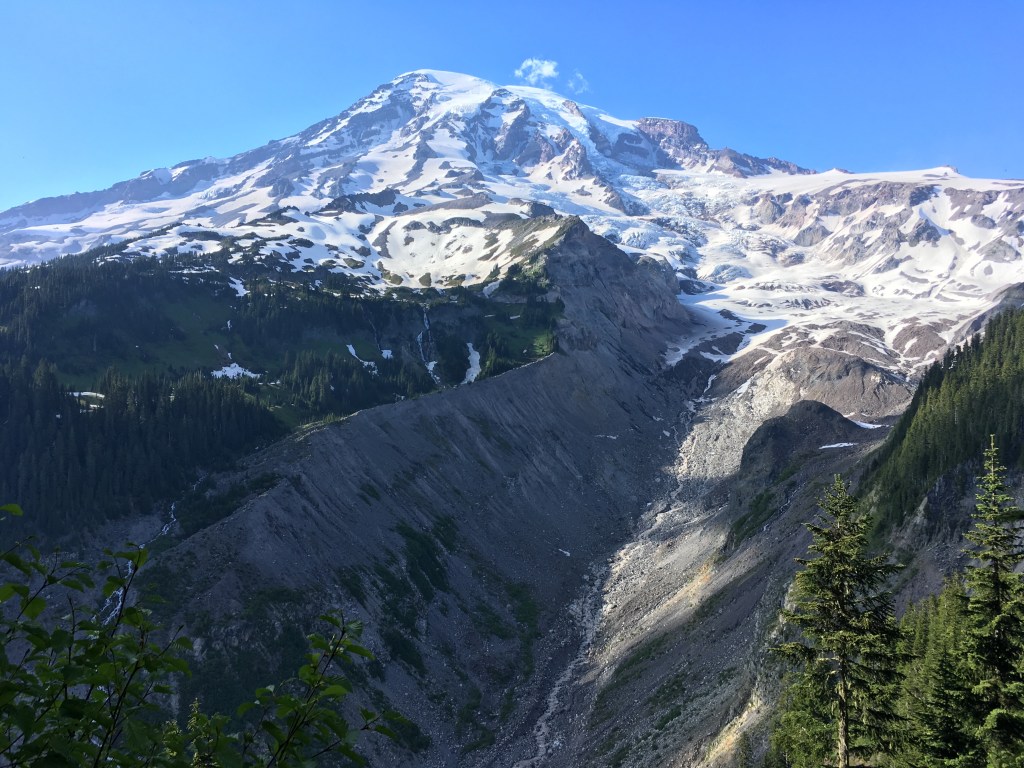
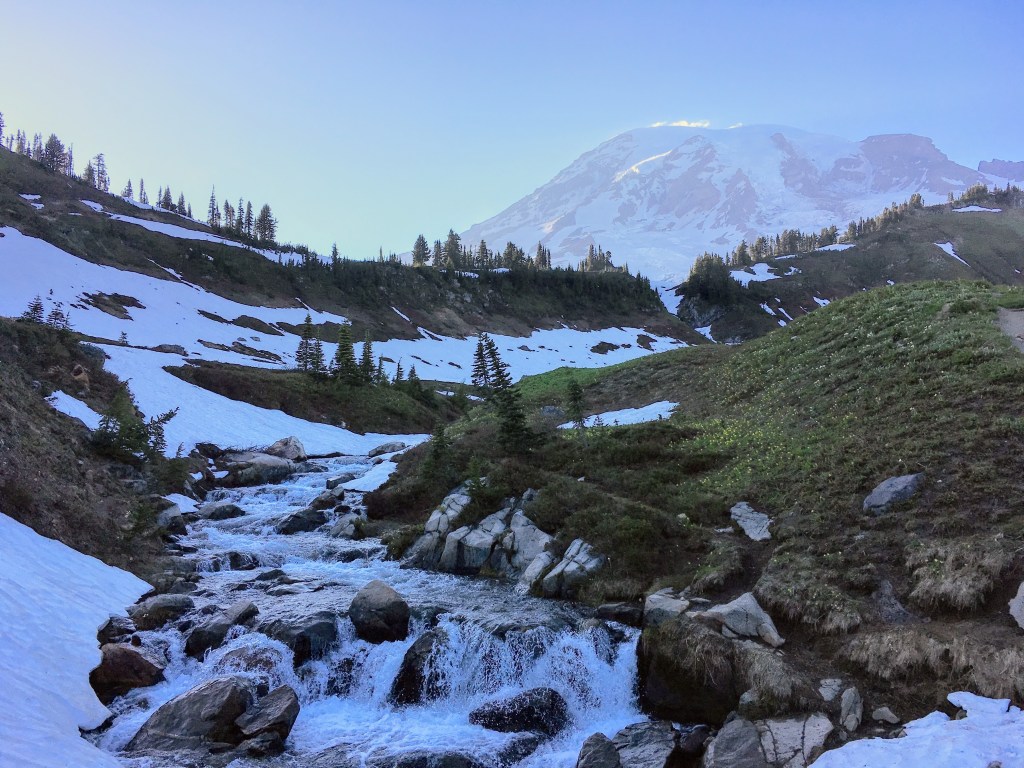
As we started off on the hike, we had to leave from the Paradise hub of the park and hike past Myrtle Falls again, which we had seen the evening before. The entirety of the hike was uphill, and “hill” is quite an appropriate term to describe the terrain although we were on a mountain side. For this mountside was composed of various hills and was a very wavy landscape. We’d round one hill, and the incline would lessen greatly for just a moment, and then we were traveling up another. The path we were on had been trodden enough that for the most part I could see the path clear from the snow with its natural gravel surface. Much of the trail was also outlined with rocks, but surrounding us, apart from the beginning meadows of glacier lilies, we were surrounded by snow. Slowly but surely we climbed higher, and Paradise was becoming smaller behind us. Reaching the higher snowy elevation of the hike, I noticed a giant gray rock canyon carved to our left by a glacier. The glacier was no longer there. It had melted down into Paradise, but its pathway was clearly visible.
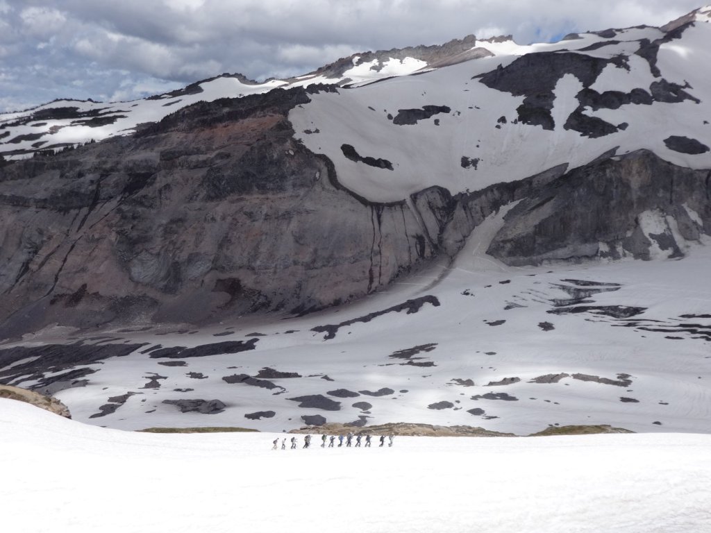
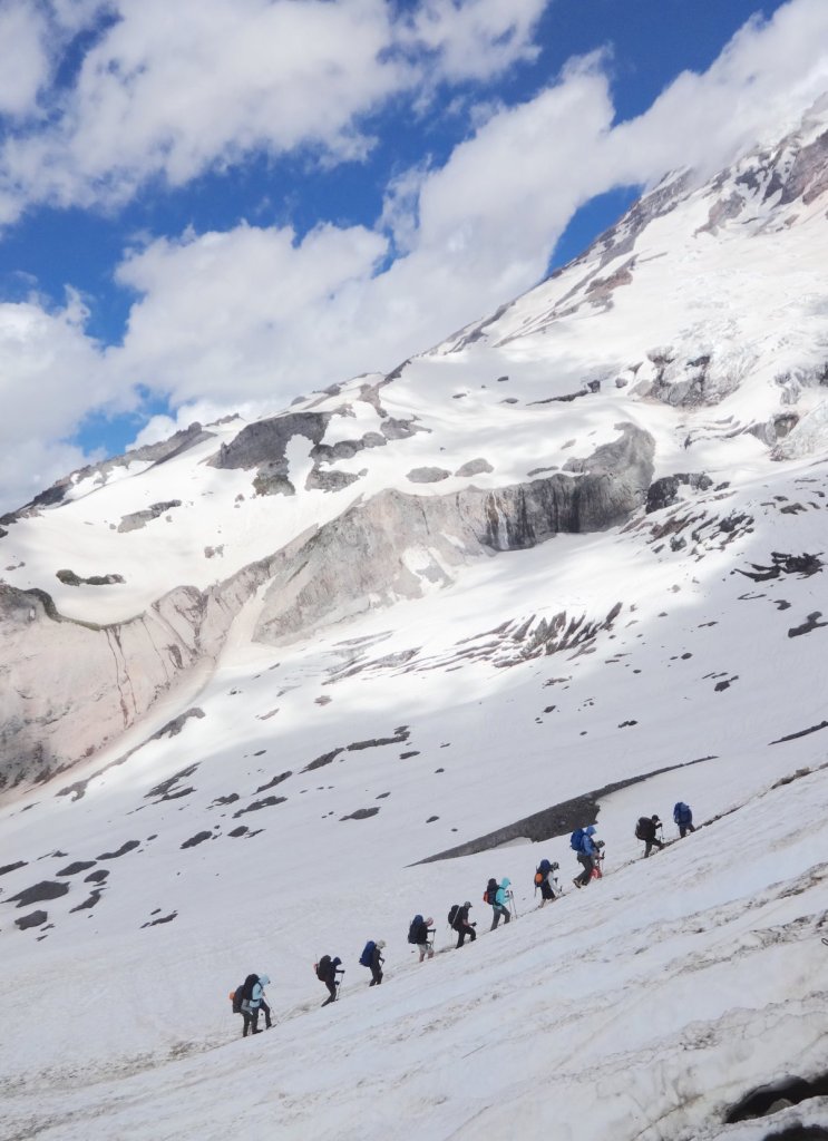
The most astounding view of the trip was not the actual Panorama Point but when out in a fair distance beside us, on the snowy sloping landscape, with a giant rocks wall behind them, and glaciers looming over them, trekked a group of mountaineers. They were traveling all in a line, as in a train pointed upward diagonally. Each mountaineer was bundled up with winter gear: hoods, gloves, and large packs on their backs. They all had trekking poles, and it was obvious they were on their journey to summit Mount Rainier. The view of this train of mountaineers, so tiny and miniscule compared to the immensity of the mountain, added great perspective; and considering the notion they were on their way to the mountain peak on an impressive journey, sparked in me an exciting admiration for adventure. To be in their presence, if just for a moment, and yet at a distance, helped create this climate of sheer adventure! I wanted to summit Mt Rainier too!…but not this time.

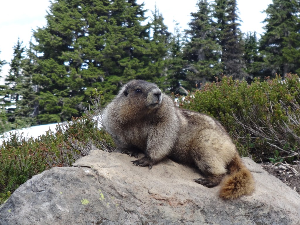
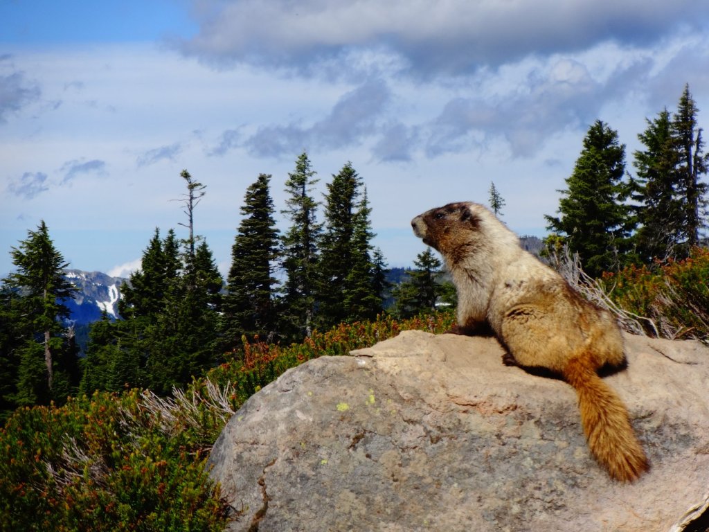
When we reached Panorama Point after about three miles, there was a leveled area of gravel, outlined with rocks like the path was. It was also fenced in with a steel cable strung between some stakes. The Park Service didn’t want people on this trail going beyond this point obviously. From here there was a 360 degree view. Looking southward, the main attraction of the point were the sharp peaks of the Tatoosh Range. Although still quite grand in their rugged and sharp attire, they looked like miniature Tetons. From Paradise, the Tatoosh mountains stood tall, but from up here, we looked about level to them or down upon their peaks. Here we could also look down and see the Paradise Inn and the whole village far below. Here the marmors were trying to steal the show and grab everyone’s attention, posing majestically in the most dignified and stately ways, as if suddenly ignoring their rather goofy nature.
Turning to the east were many layers of mountains far in the distance, stretching on in immensity. They were of various dark blue shades. The closer ranges appeared darkest and the further ones lightened up just slight enough to create a contrast, and thus I could see there were four layers of mountain ranges on display, one in front of another. Behind us, to the north, was a mountain on display as well. First was a snowy stretch of mountainside, but behind it stood the mighty Mount Rainier ever so boldly with its crumbling glaciers. Completing the 360 panorama and turning to the west, two main features came into view: The entire glacier rock canyon I had seen climbing up was in prominent display, as a gouge or scar on the mountainside, and then next to it, down in the depths of a valley, was the Paradise River, snaking around the forest.

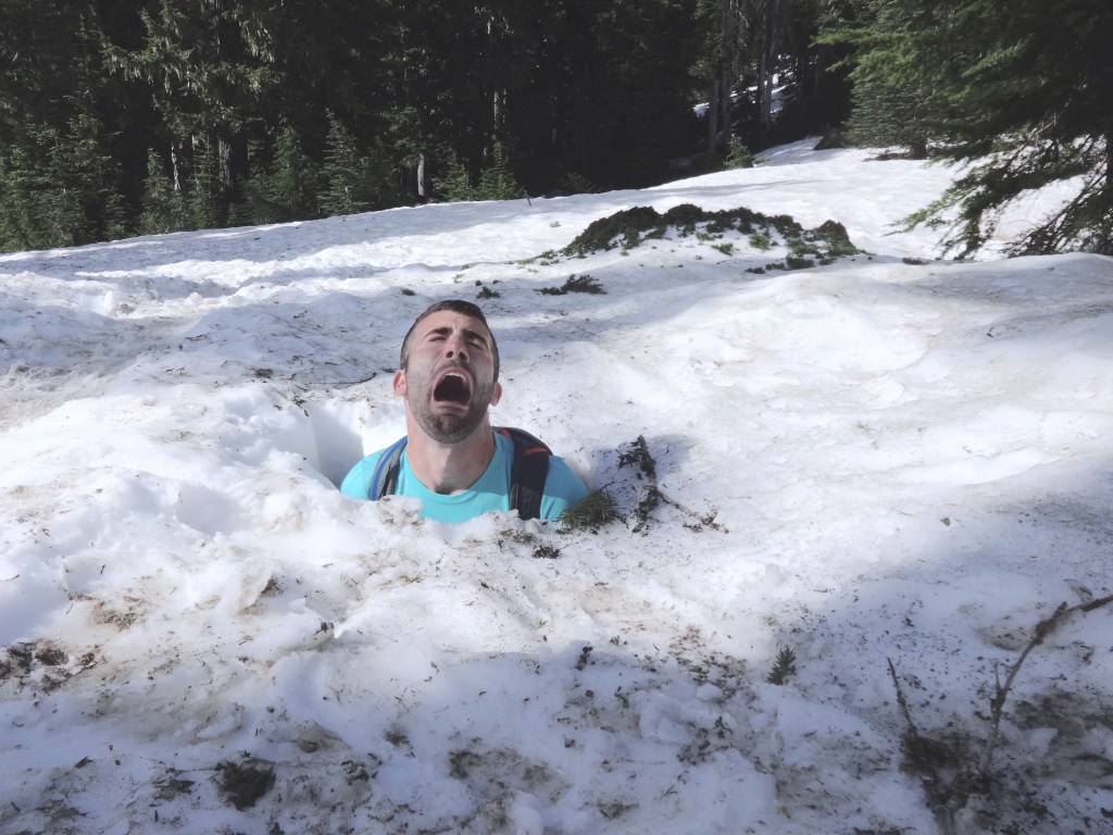
The views were nice, but I believe better views were seen elsewhere in the park. The greatest highlight of this hike was not in the views but was in the journey back down to Paradise. We decided not to complete the entire loop, as it would be a little bit longer and we wanted to preserve time to see some other places in the park, so we went back the same way we came… sort of. This time we did not stick to the path at all. Instead we slipped and slid down the mountainside, surfing all the wavy declining hills. We did so standing up on our feet. There was such a lack of friction between my boots and the snow, and such a perfect uniform slippery slushy icy consistency of the snow, that I was speeding down this mountainside. I’d launch myself forward and see how far I could keep the momentum. It was reminiscent of sliding across the newly polished wooden floor in socks as a kid, but here we were sliding down over great expanses, and it was exhilarating! I was surprised at the physics of this occurrence in that it was even possible. The fun icy descent had us back in Paradise in no time.
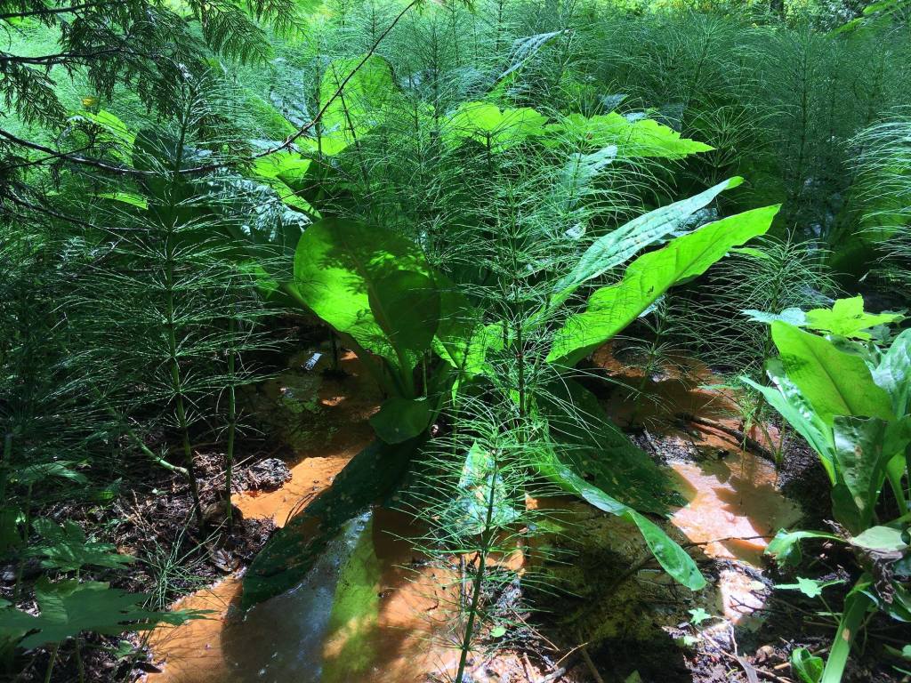
After a quick stop in the cafeteria for some burritos, we were back in the car. At eleven miles west on the park road, we stopped at Longmire, a historic section of the park with tales to be told. Here was a small flat prairie, surrounded by trees, and somewhere tucked away were mineral springs. This was the site where a man named John Longmire and his family had a homestead in the 1800s. It is also here where the Longmire’s opened a mineral springs resort. People with all sorts of illnesses came from all around the country to stay at the Longmire’s hotel and soak in the mineral springs. It was believed the waters had healing properties. Even doctors would prescribe patients to soak in these springs. Where are they? I questioned. I need to find them. Maybe the springs can heal my Ulcerative Colitis. It was unlikely but I was willing to try anything. If only I was here about two hundred years ago. The closest thing I found to a spring was some sort of water source pooling in bright orange. It very much resembled the leakage of abandoned coal mines I see in the forests of Kentucky, but it was likely the minerals of the spring oxidizing and changing color…It was not very appealing.
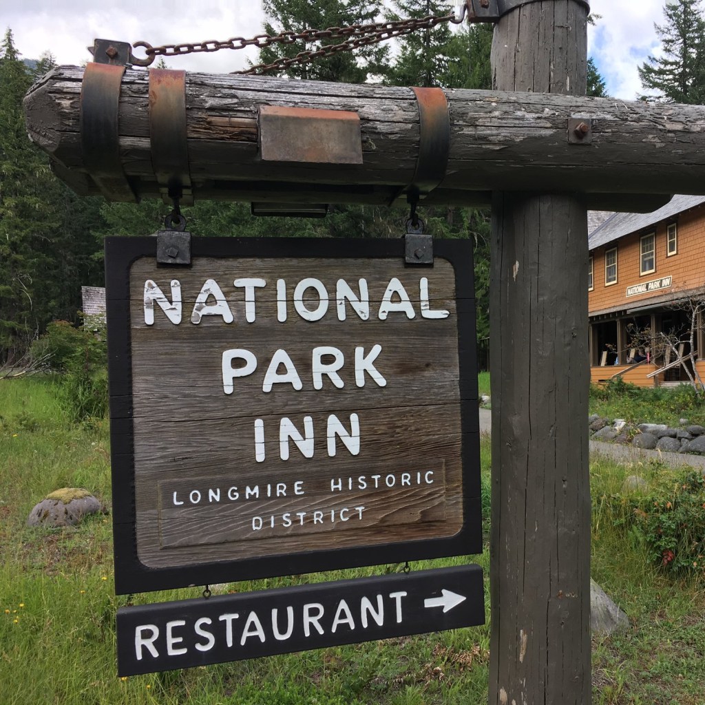
In this Longmire area was also a short path called the Trail of Shadows which traced a meadow, which next to stood a small collection of historic buildings from the Longmire’s resort days. They were all built in the rustic National Park Architecture style. The Longmire’s hotel today stands as the functional National Park Inn. Next to it was an old rustic gas station and “comfort station,” as they called it back in the day, with a tall stone foundation and an overhang with two old gas pumps that were probably once just more gas pumps in the wild. Another building that used to be the park headquarters is now a small museum on Longmire. It’s most fascinating feature to me were some antique taxidermied animals. Maybe it was their age or the way they were poorly put together, but to me they were funny, especially this taxidermied pine marten flaring its nostrils and showing its teeth, very territorial. As we meandered around the Trail of Shadows, at one point we veered off onto an unmarked path. We ended up crossing a suspension bridge and found a village of unmarked cabins. These weren’t on the map. There seemed to be one central building among them. We walked inside just for a moment, for I quickly realized we weren’t supposed to be here. There were couches, tables with board games, and a kitchenette. This was a part of a staff lodging complex. I concluded. It was like a community center. How cool it would be to work in a National Park for the summer, I thought. What a foreshadowing moment.


Just a couple miles up the road in the park was our campground at Cougar Rock where we had spent the night the night before. I thought of taking a break, hanging out at camp, maybe relaxing in the tent, perhaps doing some reading, regrouping and planning the rest of the evening. Our campsite was number 20, so there was a bit of slow driving through the campground to get to our site. When we arrived I was stunned to see our tents were not there. Someone else’s bright orange-colored dome tent was there instead. All our stuff was gone! I was completely taken off guard. Did someone steal our stuff? Did someone rob our campsite? How dare they! What a nightmare! I got out of the car for I was going to confront these imposters, but no one was there. The feeling of offense grew stronger. Then I looked to my right. Our tents and all our camping gear had been throw alongside the campground road. The audacity! Then I vaguely remembered something. I think at one park we are to switch sites in the midst of our stay… It wasn’t this one, already, was it? I pulled out my itinerary. I wanted to prove my suspicion wrong and reclaim my site with my reservation documentation. I unfolded my itinerary, and embarrassment immediately set in. I was the one at fault. We were the trespassers. We were the squatters. We were the offenders. We were at site 20, but we were supposed to have moved to site 2. I was embarrassed in front of Zach, to myself, and to whoever else might be in the campground watching us. We got back in the car and I drove to site 2. It wasn’t that far, only 18 sites away. I didn’t want to deflate my air mattress and deconstruct my tent, pack it in the car, only having to reassemble everything. Instead I decided to take a walk of shame, picking up my tent with the air mattress and all inside it. The tent floor was sagging greatly as I was walking it down the road to our new site. I succeeded at trying not to notice anyone else around me, for my head hung low in shame. Back at the tent I situated everything in its place, and carried on, hoping to blend back in among the other campers in the campground.
I don’t recall what Zach was up to at this moment. I was probably too inner focused on my own embarrassment, but when camp was reassembled, I proceeded to seek out some firewood to purchase for a fire we’d have at night to cook our soup, and I rested my head in my tent and read some more of my book on wolves. After a brief rest, we took the short trail from our campground to Carter Falls. The trail was a 1.3 mile segment of the Wonderland Trail, which in its entirety is over ninety miles. We rushed along the path beside Paradise River to the falls, which spilled down from about fifty feet in height. It’s described as a “horse-tail” falls, but the falls splits in two over a protruding rocks, near its top, to create almost two side by side falls. So I guess its a “horse-tail” falls if the horse has two tails. It was a pleasant fall for such a short hike from camp, but nothing to really write home about. It reminded me much of a fall I’d seen in the Great Smoky Mountains.
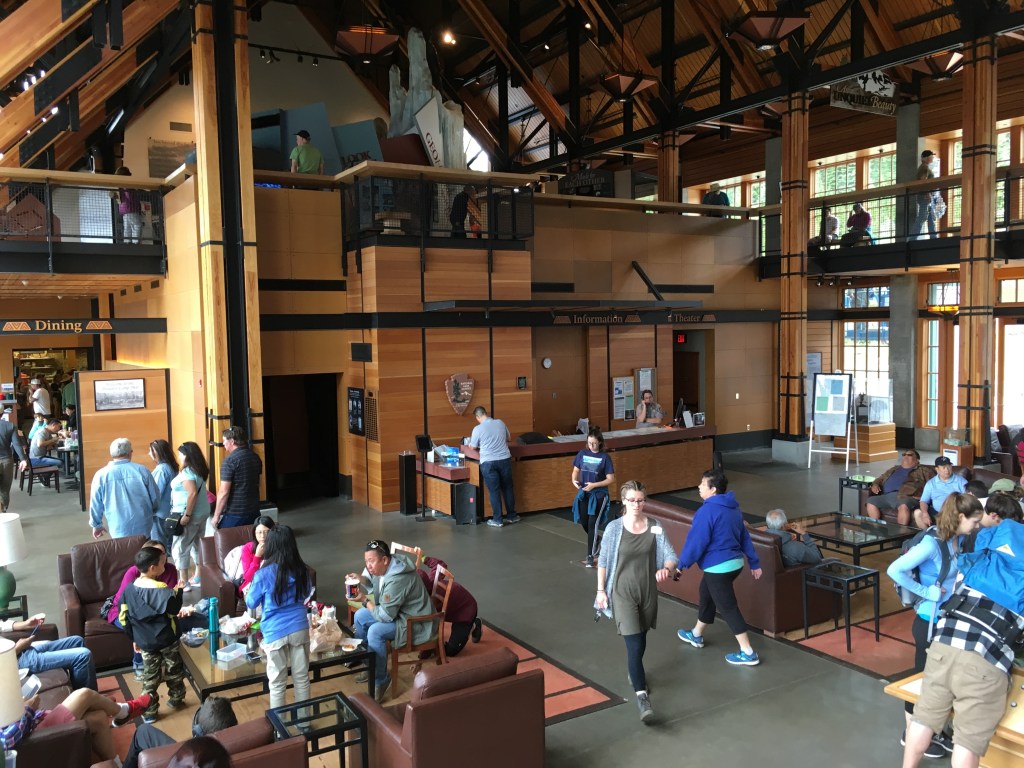
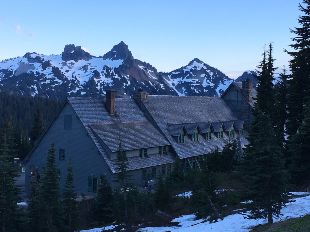
After our quick visit to the falls, we drove back to Paradise. I wanted to hang out in the Paradise Inn again like we did the evening before. There was a balcony up by the rafters in the eves of the roof with wooden desk and warm lamps. I bought some hot tea from the inn’s cafe and a few more postcards. I’d fill them out as well as update our happenings in my journal. When I went to purchase my postcards I also bought a green bandana that itself was an artistic map of the National Parks of the Pacific Northwest, of Olympic, Mount Rainier, and the North Cascades. It was a perfect souvenir covering all those parks.

When night set in, we headed back to the campsite, and this time our tents were still there. Phew! I started a fire. I peeled the label off my can of soup and opened its lid. I set it just aside the fire. It was time for supper. This would be the concluding night of our stay in Mount Rainier National Park. This was also the last full day of Zach on this summer’s adventure. The next day, as planned, I’d take him to the airport in Seattle to travel back to Kentucky. Though this leg of the adventure was over, I had much still before me as a solo traveler. I would go on a backpacking adventure in North Cascades National Park, venture on to Lake Roosevelt, and would make my acquaintance with the national park of all National Parks: Glacier. My health was also about to take a turn for the worse. I’d struggle physically, have to come to terms with reality, learn how to accept it, and find the resolve to carry on amidst hardship.
If you enjoyed reading this, check out my book “Still, Calm, and Quiet“
Check out my previous entry here: “Mount Rainier: the noblest of peaks”
Visit www.joshhodge.com